Hidden Antarctic Secrets - All is Revealed
what "they"
don't want you to know
Extraordinary claims require extraordinary evidence -
Carl Sagan, 1934-1996
The weight of evidence for an
extraordinary claim must be proportioned to its strangeness
- Pierre-Simon Laplace, 1749-1827
Antarctica is a long way away from where you live, wherever you live. Not many people have been there, it's difficult and expensive to get there, it seems like some sci-fi ice-planet place and really exciting.
It isn't "secret" though, just not well known. What goes on there is largely uninteresting to most people and is mainly very technical, complicated scientific stuff that is not easy to understand.
All of this contributes to numerous conspiracy theories about UFO's, aliens, Nazi bases and other forms of woo-woo. With the advent of the internet and especially of access to satellite images on Google Earth there are plenty of purveyors of snake-oil ready to "interpret" ice-bergs and other ice patterns and structures for the benefit of the gullible, they are never just natural formations, but "clearly" alien or at least secret facilities.
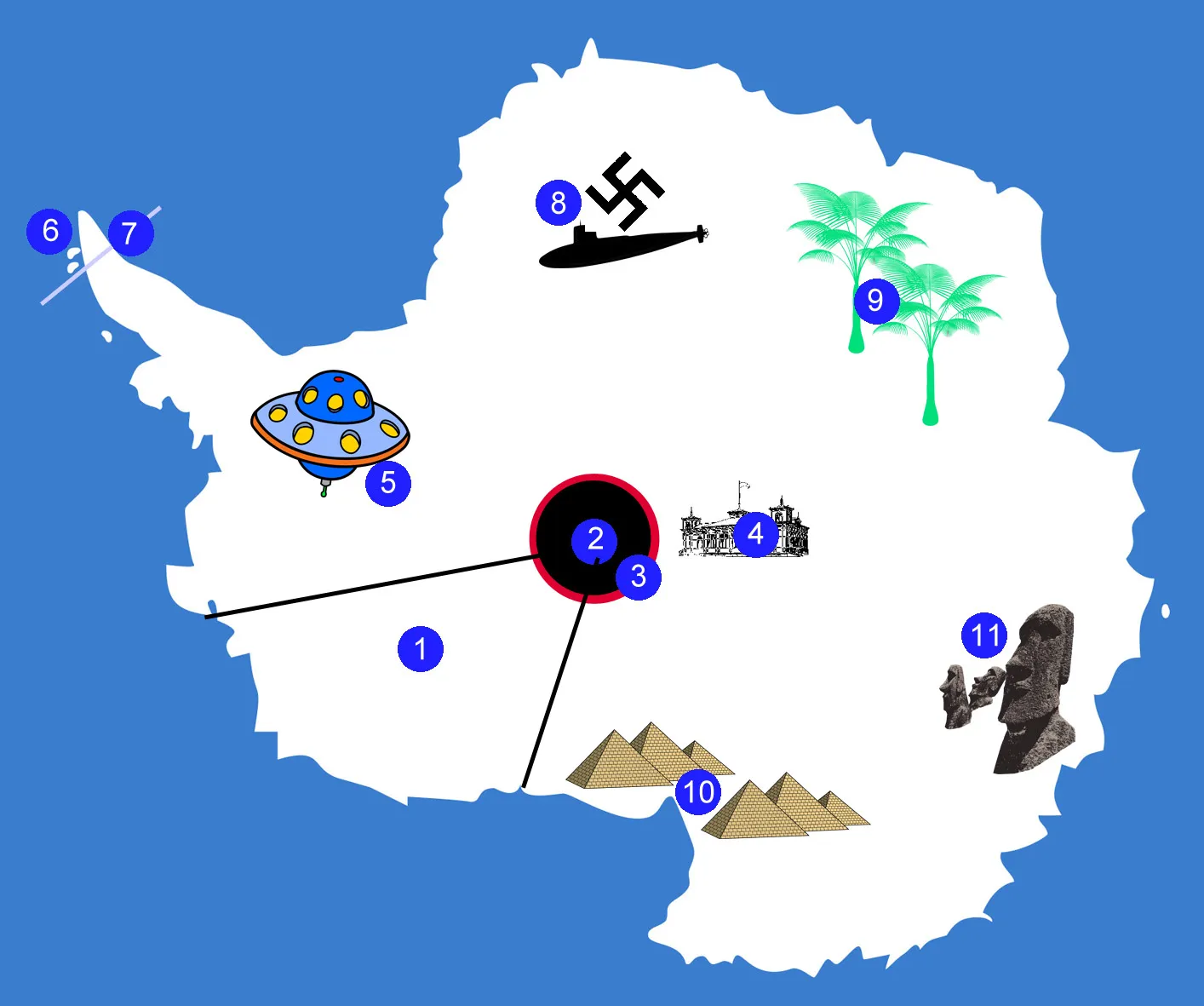
Key:
1 - The Forbidden Sector. No-one knows what happens here, no one who has been has ever come back, if you try to take a peek at the border you are grabbed by security penguins and taken in.
2 - The Hole at the Pole. This connects with the Hole at the Other Pole and to the Hollow Earth and those who live there.
3 - The Wall Around the Hole at the Pole. This stops people from the Almost-South-Pole-Station from falling in the hole and keeps out immurgrunts.
4 - The Almost South Pole Station. Because there's a big hole where the actual Pole should be (obvs) you can't build a research station there so instead it's nearby, this means it easy to keep an eye on all the ufo's and other alien technology that comes in and out of the hole.
5 - UFO Base. UFO technology was first established in Antarctica at the end of WW2 by the Nazis who did the obvious thing when they thought they might lose the war and moved there to test-fly UFO's. They have been doing it ever since, secretly... about 80 years so far and counting...
6 - Visitors Land. The magnetic fields in Antarctica are manipulated to cause compasses to lead everyone to this area wherever they think they are going and think they might be. This prevents anyone finding out about the secrets in Antarctica "They" don't want you to know about.
7 - Visitor Land Barrier. A big plywood barrier painted to look like distant mountains and icebergs that hides the rest of Antarctica behind it.
8 - Secret Nazi Submarine Base. Established at the end of WW2. A tunnel at the ice edge leads to a base built into a giant ice-cave hundreds of miles inland so submarines can come and go secretly on clandestine missions.
9 - Tropical Area. No-one would expect an area of tropical weather and rainforest in Antarctica, so that's exactly why one has been established and kept secret well away from prying eyes, you wouldn't guess it was here would you? clever eh? <taps side of nose>.
10 - The Pyramids of Antarctica. Built by an ancient and powerful race and hidden under the ice. Every now and then one of them pokes out accidentally and photographs are taken, but by the time anyone looks again, the snow is heaped back over it and it disappears from view.
11- Land of The Ancient Race of Super-Beings With Big Angular Heads. Some of them tried to leave many years ago and made it to Easter Island where their enormous weight made them sink into the ground and a simple common bacterial infection turned them to stone. The bacterium cannot live in Antarctica so they continue their highly sophisticated secret society under the ice, just occasionally sending out for pizza.
Everything referred to on this map is made up, some of it by me, most of it by other people
The most amazing part is that there people who believe this stuff is real and think there is a conspiracy to keep it all secret from everyone else in the world. There are books on it and of course endless youtube videos made by bloke-at-the-bus-stop-productions™ (or similar) who don't know what they are looking at and/or repeat lies from others or simply make up their own lies. It's really easy! I did it with some of the items above.
Often the most compelling "evidence" for the believers is that they haven't been there to see it for themselves and they probably haven't ever met anyone who has been to Antarctica therefore the truth is being kept from them. Well I've never been to Albuquerque and I've never met anyone who has been there, but I do believe it exists. Anyway, now you've met me (sort of) and I've been to Antarctica and I can tell you none of the above stuff is true - I would say that wouldn't I? ;o)
Big structures, monsters, rows of tanks, hidden ufo's, crash and take-off marks etc.
Antarctica is a big mainly frozen place, the wind blows a lot, it snows, it thaws too sometimes, water expands when it freezes, ice that is over water can crack making unusual patterns. Google Maps and the like aren't real-time images, but may get updated without notice showing changes that are actually years apart. There are also things going on in Antarctica that don't get a lot of publicity and sometimes people can't be bothered to find out what they are, but that doesn't make them "secret" any more than it is secret that I just had a ham and cheese roll (doh! - now I've given it away).
Here's some examples of Google mapping images of Antarctica that were misunderstood either genuinely or deliberately and had fantastical stories made up about them. This stuff gets online and into the printed press.
Not a Giant Buried UFO
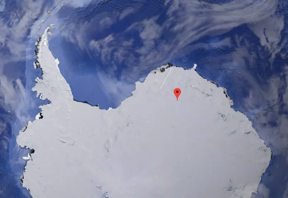
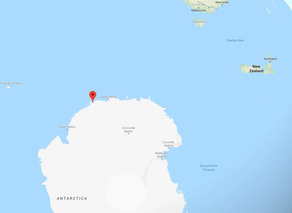
This one hit the news in mid 2018, described by some as as a "Buried UFO", the line of objects in the left hand picture is about 1400 metres long, here at 75° 0' 47''S 0° 4' 52.71''E. It is in an area known as Dronning Maud Land, map right. Since I first put this page up, Google have now added a marker of what is there, so there shouldn't be any further ambiguity.
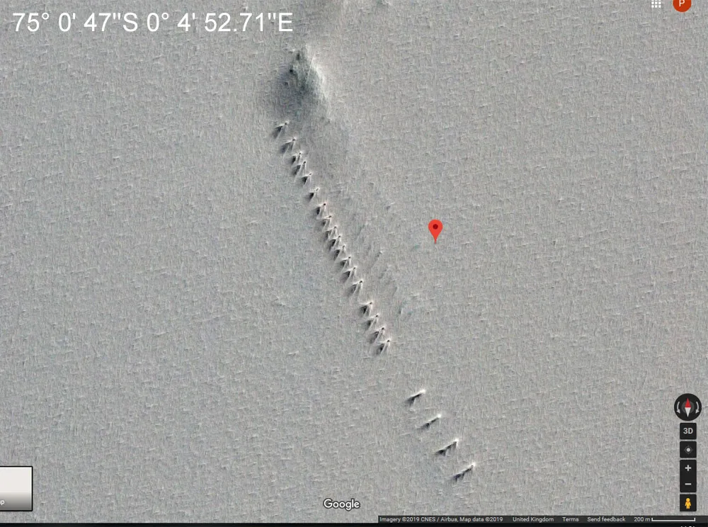
If you put the co-ordinates into the highest resolution map of Antarctica ever made, REMA, what comes up is not a buried giant UFO, but the location of the German Kohnen Station a summer only research facility opened in 2000. You can't see those things on that map because it is a relief map whereas the Google image is a satellite picture, no-one is trying to keep it secret. If you look elsewhere on the REMA map, there are the positions of other research stations given, but no structures shown, though there are quite comprehensive drop-down information boxes.
You see that small rise in the ice at the top? That's a nunatak, the peak of a mountain that projects through the top of the ice. They make great landmarks on the smooth expanse of generally featureless ice and will be one of the reasons the station is where it is, because it makes it easier to find in less than ideal visibility.
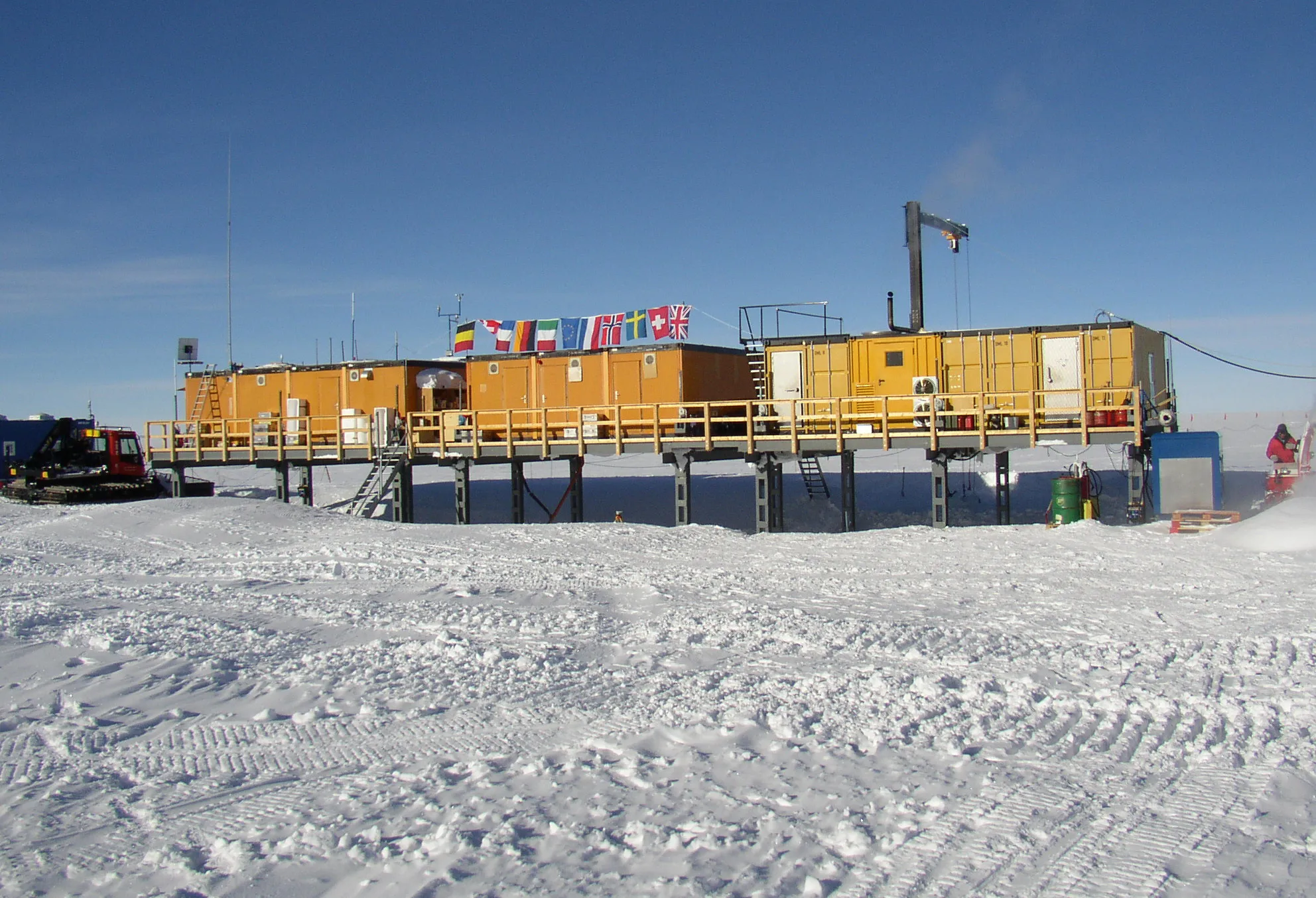
Kohnen Research Station (Germany)
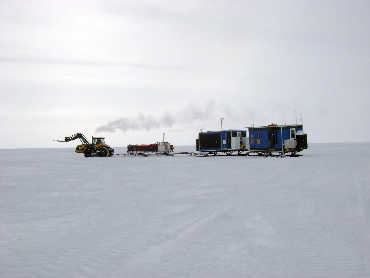
A tractor train similar to the one used to supply Kohnen
But that doesn't look like (hang-on, I'm going
back to count) 22 things on the ice! Maybe it's a hidden
UFO after all?
Kohnen Station is resupplied from Neumayer Station (also German) 757km away by a convoy of vehicles twice a year. This convoy usually consists of 6 towing vehicles and 17 cargo sledges (that's 23 individual objects). As it is situated on a vast ice plateau, any vehicles, sledges and outside cargo will be arranged in a long line at 90° to the prevailing wind, an arrangement sometimes called a "berm". In this way snowdrifts build up in tails that stretch away from the object making it relatively easy to dig out any one without needing to clear any of the others. If they were stored closer together, much more snow could build up in and amongst the cargo and vehicles making finding stuff you knew was around there somewhere much harder to get to.
That original satellite picture is of vehicles, sledges and cargo laid out at 90° to the prevailing wind direction resulting in long wind tails of drifted snow. I suspect one reason that this gained traction in the press (apart from it being the absolutely laziest form of journalism possible and an over enthusiastic attention-seeking made up story), is that the station is German and the story appeared in the English language press. Otherwise some-one would have seen the pictures and said "Here, that's not a UFO, that's where our Gunter has gone to in the Antarctic" - or similar.
It isn't a giant buried ufo, it's a modern German research station
Not a Pyramid
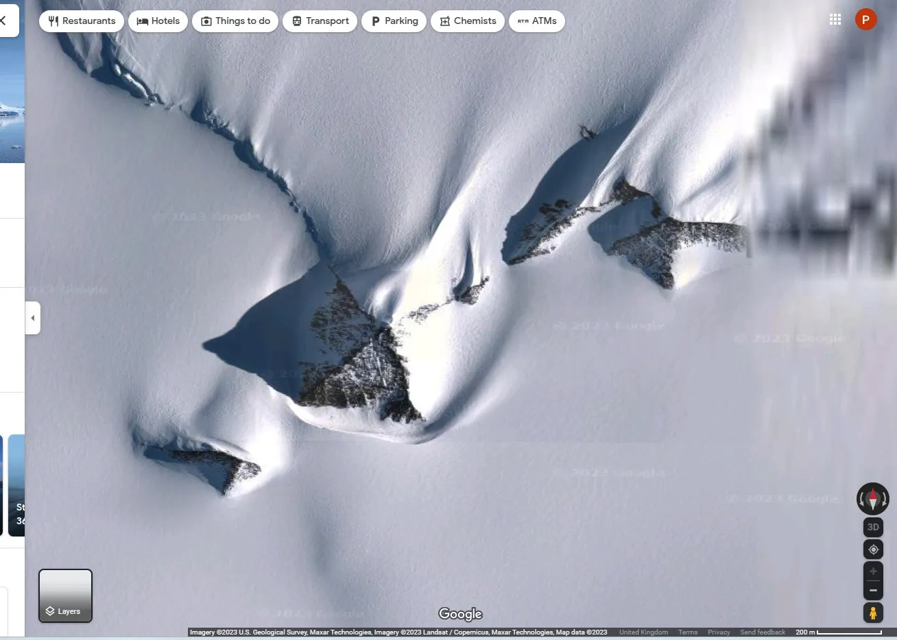
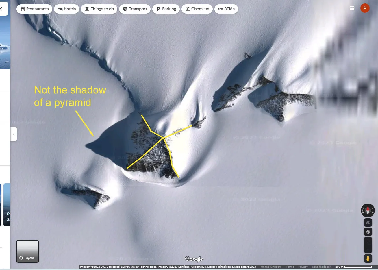
Some mountains look a bit pyramid-like from some directions just like this one does here at 79°58'39.3"S 81°57'32.2"W. An unnamed peak (most of the peaks in Antarctica don't have names) in the Heritage Range of the Ellsworth Mountains discovered in 1935. It is notable because it is pyramid-like, but that's just a coincidence and not an indication that it is man or alien made. While it is pyramid-like it is actually far from being anything as regularly shaped as an actual constructed pyramid might be.
It is a nunatak 1,265m (4,150 feet) in height, the tip of a mountain sticking out of the ice.
If you went to the pyramid shop, you wouldn't buy this one would you?
I've drawn lines on the ridges of the mountain and even though I've been quite generous in smoothing them out a bit, you can see how far out they are from being straight as you'd get with a constructed pyramid. Also, look at the shadow to the left to see how irregular the shape is.
Not a "Motte and Bailey Castle" or Evidence of a Lost Civilization
Here's one from 2017, though it keeps cropping up again as it is "rediscovered". This time, the assorted fantasists imagine it is an uncovered Motte and Bailey castle, a design peculiar to 10-13th century Europe, except here is one apparently in that part of Antarctica directly south of Australia. See it here at 66°17'10.5''S 100°29'07.8''E.
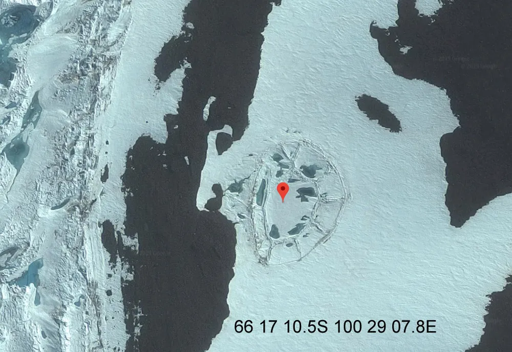
It's about 120m across which makes it of the appropriate size range and has two sort-of circles, though the whole thing appears to be more or less completely flat rather than having any significant raised earthworks which in part define a Motte and Bailey castle, the mounds of such castles in towns, cities and in the countryside in Europe are particularly enduring across the centuries even when all other evidence has gone.
Europe has many, many examples of them, from the well preserved and in-use Windsor Castle in England to a whole range in various states of disrepair, though all with substantial earthworks.
But when I think about it, why I am spending any time at all talking about about why two very rough concentric circles in Antarctica aren't an example of a medieval structure found on the other side of the world on the flimsiest of evidence? Maybe it's part of a deeper mystery? No it's just fanciful thought by people who have seen pictures of these two things and drawn a conclusion in the way that if you were a bit unusual, you might think the moon and hamburger were the same thing because they are both circular.
Those dark blue patches inside the rings are water above ice. The whole thing is probably a pond or shallow lake that has frozen over during the winter and now it is spring. Warming temperatures and possibly a fall in water level by draining has caused the surface ice to fall and crack in the pattern of two very rough circles . The cracks have allowed some of the remaining underlying water to flow over the top of the ice.
Such patterns and movements of ice and water are commonly seen wherever there is standing water with seasonal freezing. This explanation may not be exact as I haven't visited the site at ground level, but it is along the right lines and many similar examples of this phenomena can be found in the colder climates of the world. It is also a lot more accurate than some fanciful 1,000 year old castle belonging to a far distant culture 800 years before anyone even knew Antarctica existed.
It isn't a medieval European castle, it's a pattern in a pond or small lake.
Not a Monstrous Skeleton
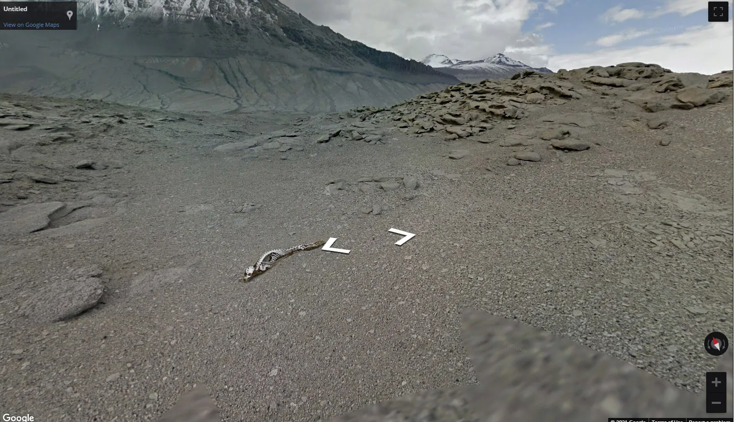
A good example of the "I don't know what it is and my opinion is as good as anyone else's so I can make up what I want instead of making any effort to find out" school of thought. You can see this on Google maps street view here.
It is the skeleton of either a Crabeater or Weddell seal that died and dried out over a long time period.
There are a number of these skeletons in the area known as the "Dry Valleys" in Antarctica, they are surprising in that they are up to 40 miles from the sea and at up to 5,000ft altitude in the mountains. Carbon dating shows that they are often hundreds of years old, the oldest found being 2,600 years old. The environment is extremely cold with strong drying winds, so they are quickly freeze-dried after death and the lack of disturbance by carrion feeders gives the impression that the carcass is quite recent rather than ancient.
They are the remains of seals, probably juveniles, that took a wrong turn to the sea, possibly mistaking the light glint of a distant glacier for the sea and heading that way until exhaustion, cold and starvation brought about their demise. The harsh environment both preserves and then slowly erodes them, the skeleton in the picture could have been where it is in exactly the place the seal died since the 1700's or earlier. More about mummified seals here.
It's not the skeleton of a giant monster, it's the very old skeleton of an unfortunate inexperienced seal.
Not a Ship Made of Ice by Nazis, Aliens or "Elites"
"Ooh look that cloud looks a bit like a lion" - Headline - Giant Lion Found in Sky!
We don't expect to see headlines like this but we do get a similar thing sometimes by people looking at relatively poor resolution satellite pictures of icebergs. Here's one that was in the news in 2020. Someone found an iceberg that looks a bit like a cruise liner which it does in a sort of children's toy-boat kind of way. This was on Google maps at 66°54'00.0"S 163°13'00.0"E but has been updated since and isn't there any more.
The first thing to say is that as this is a satellite view, the "boat" would be on its side and in some significant distress. It does provide a nice example of how the sea shapes icebergs and what happens to them as they age and erode though.
The berg has fairly recently tipped up due to some combination of differential erosion of the parts that were in and out of the water and also most probably with some degree of break up that have contributed to it becoming unbalanced and rolling over through 90 degrees so what was the horizontal water-line is now vertical.
The line of "windows" is characteristic of erosion at the water line by waves over a period where the berg was stable, the rounded bottom of the "ship" shows smooth ripples caused by erosion beneath the sea surface before the berg turned over and the more angular "funnels" and "superstructure" are characteristic of above-sea erosion.
Picture left, a (different) large ice-berg at sea-level showing the line of water-level wave erosion and the more angular result of the erosion of the region above the sea. If this berg tipped up it would look a bit like the one above, but probably less boaty.
There's also the issue that in the "boat" berg above, 9/10ths of the ice is under the surface, so the actual shape overall will be not at all boat-like.
It's not an ice boat, it's a tipped up ice berg.
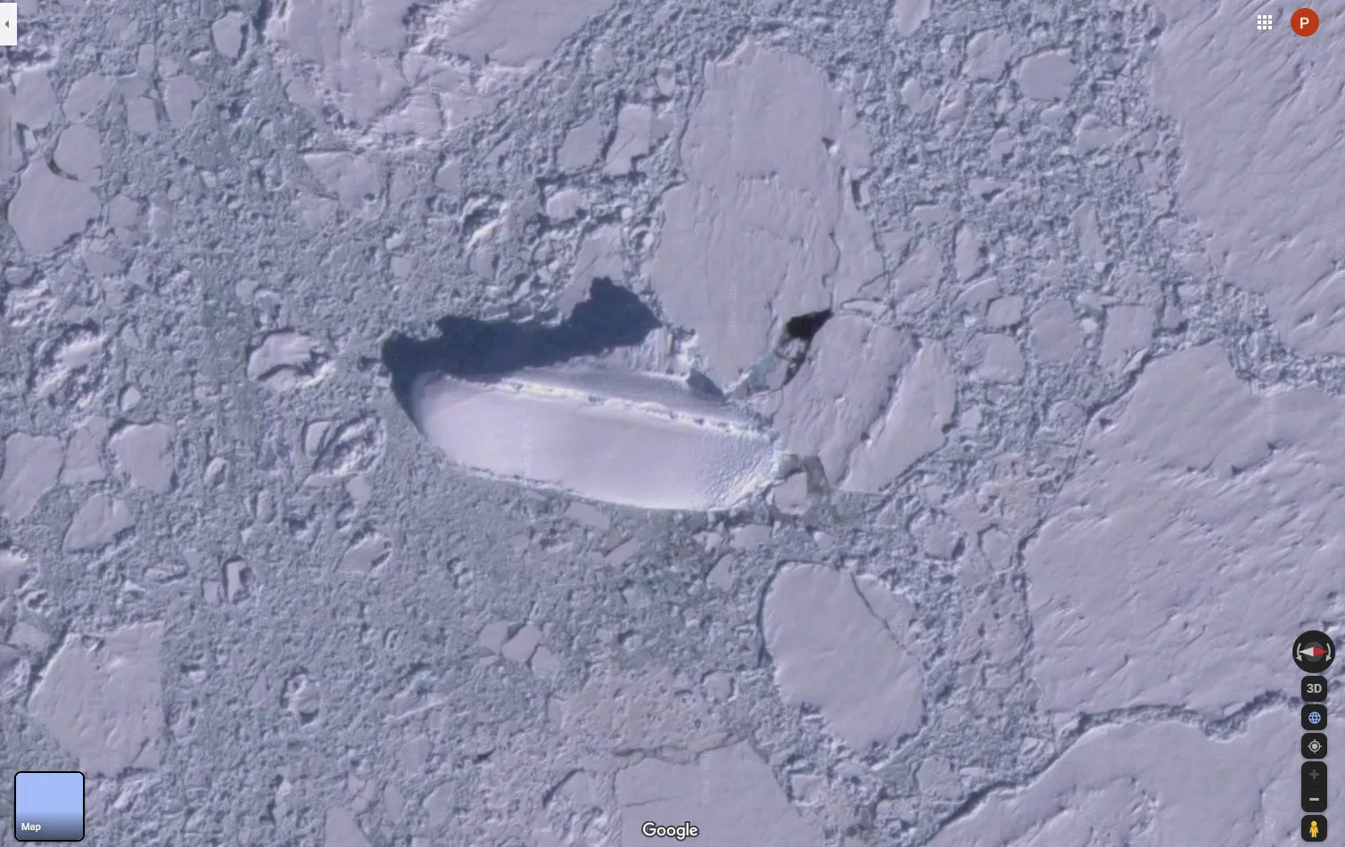
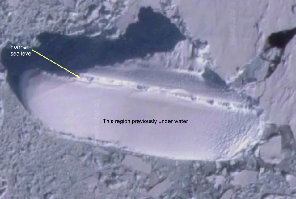
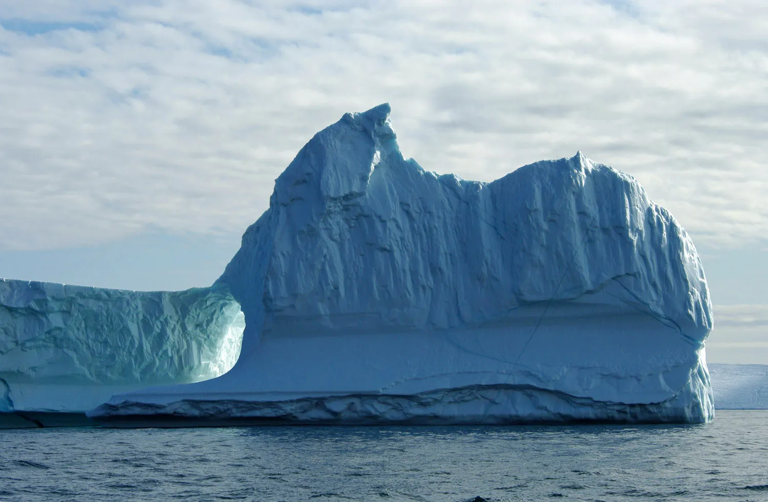
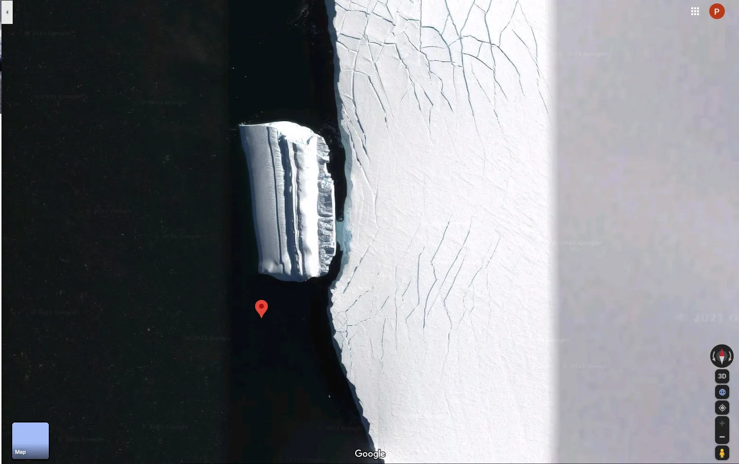
Not an Alien Base
Here's another perfectly explicable ice-berg that has been imagined into an "Alien Base", see it here at 72°43'13.5"S 78°40'21.6"W
This ice berg has fairly recently tipped up 90 degrees and so we are looking at it in a satellite view as it would have been from sea-level before it tipped over with the added ability to see what was under water. We can tell the tip happened just recently as it the smooth formerly below sea regions haven't yet developed angular erosion consistent with being out of the sea for very long.
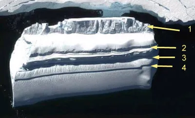
- 1 - The region that was above water that has been eroded by wind with marks of cracks and fissures as ice fell off.
- Between 1 and 2 - the wash and splash zone, this part was above the water level but has been washed smooth by waves similarly to how waves at a beach wash the sand smooth in front of dunes or cliffs.
- 2, 3 and 4 - former sea-level lines where wave action has cut into the ice. This berg has shifted position because pieces will have fallen off and changed the balance, so altering how it floated leading to successive wave erosion lines and new sea-level lines.
However it formed this shape and pattern though, it's obviously just a big lump of ice that has drifted up close to a small ice-shelf, the "connecting" part is small pieces of floating brash ice that extend along the front of the shelf. Quite possibly this brash is icy rubble formed when the berg partially broke up causing it to tip to a new stable position.
It's not an alien base, it's a tipped up ice berg.
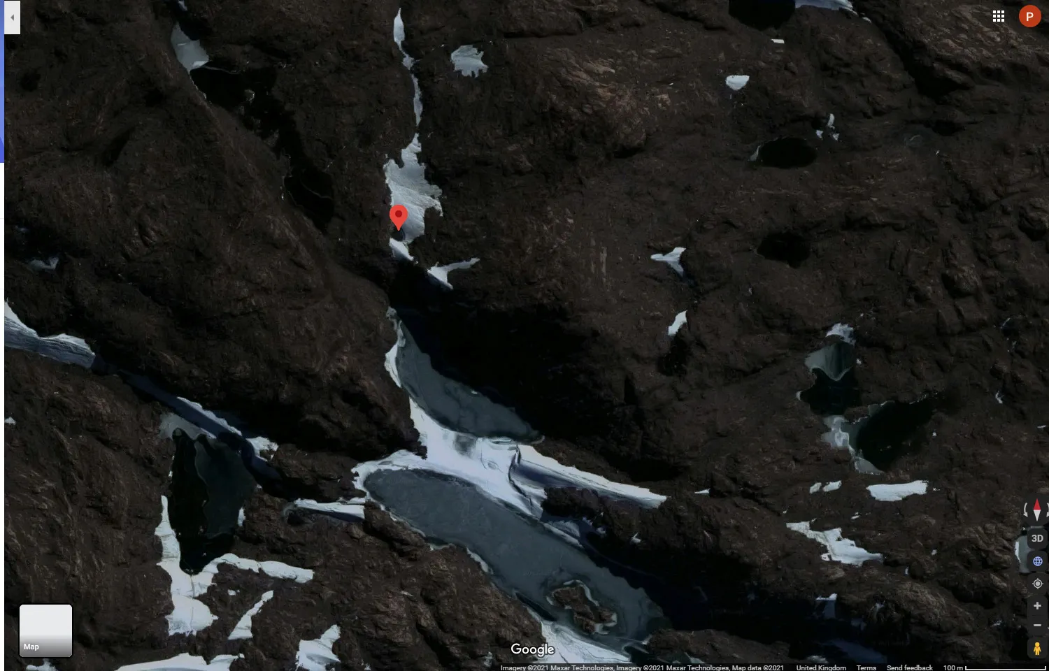
Not a Crashed or Hidden UFO
Have these people got nothing better to do with their time? I mean they spend hours searching vast areas of terrain looking for things they don't understand and then make stuff up about it. Then again I noticed an alien disguised as a house spying on me the other day so you can't be too careful.
Is this a hidden ufo?
hint - no it isn't

Obviously an alien disguised as a house
Left picture, you'll see this across the web being described as a crashed or hidden ufo, it's here at 66°16'24.1"S 100°59'04.8"E.
It's a round pool of meltwater sitting above some ice it probably melted from surrounded by rock. The angle of the picture has it partly obscured by a nearby rock, but there isn't anything deliberately hidden about it. Zoom out a little to see exactly the same shade and texture of other meltwater pools, it's just that this one is a bit hidden and more perfectly circular so it makes for a better claim.
It's not a ufo, it's a pool of water.
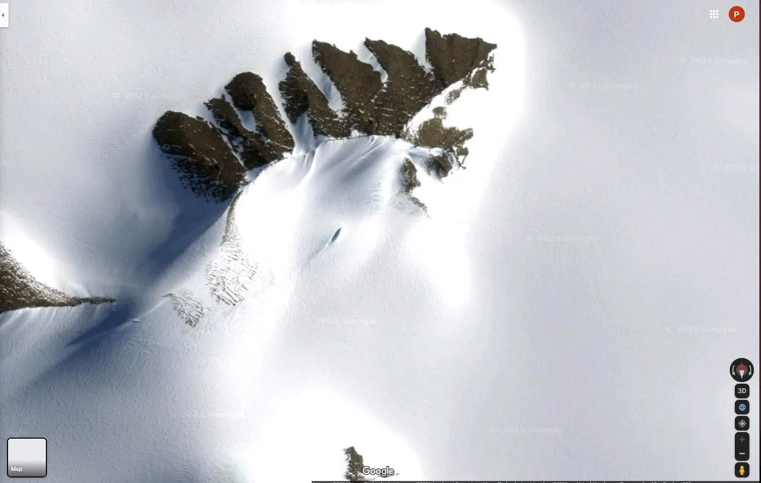
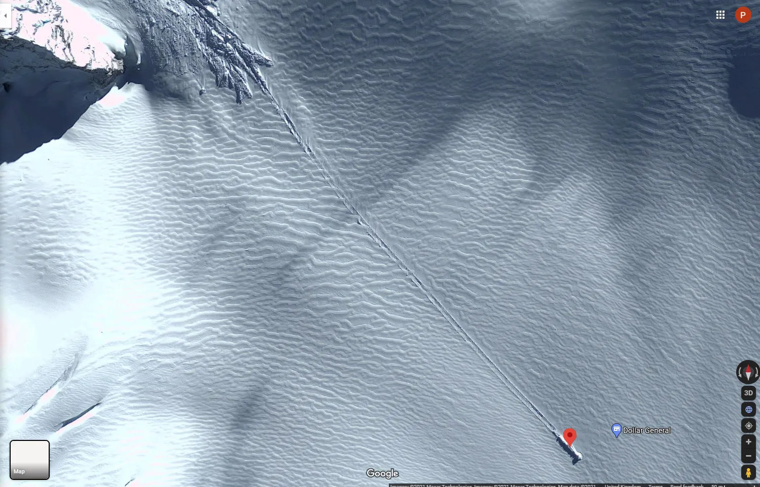
Not a Crashed UFO
Another sighting of a "crashed ufo" here at 80°34'08.4"S 30°05'19.3"W.
It's that little dark streak at about 45 degrees in the middle of the picture that is the object in question.
What was that? Yes I do mean that small nunatak, a rocky peak projecting from the surrounding ice with a clear wind-tail extending to the bottom left in line with the other wind-tails produced by the rest of the rocky outcrops. You're getting good at this, see we don't have to invoke some made-up garbage to explain common readily describable phenomena after all.
It's not a crashed ufo, it's a rock.
Still not a Crashed UFO
Next up is a rock fall on the sub-Antarctic island of South Georgia, here at 54°39'44.6"S 36°11'42.5"W which some imagine might be a crashed ufo (they came all the way here, went to Antarctica and then crashed, doh!).
To the top left are some similar but much shorter tracks from the same rock fall that caused one particular rock to roll much further than the others probably because it was bigger, rounder and happened to be on a course that took it straight down the slope.
It's not a crashed ufo, it's a rock.
Connected pages:
Hitler's
Secret Antarctic Base (apparently) |
Military activity,
hidden stuff and other nonsense