Antarctic Regions Maps and Pictures
Smaller
area maps of Antarctica with photographs
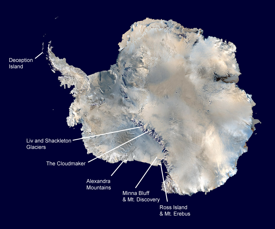
Antarctica is an entire continent and while its landscapes tend to be on the theme of rocks, snow and ice, there is a variety of geography that is not often seen or known. Here are a few places about the continent in a little more detail.
Geography - map skills
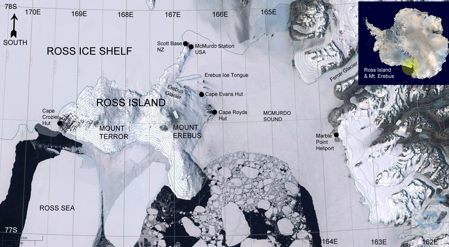
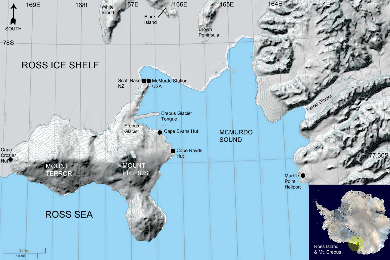
Ross Island, satellite view (l) and diagrammatic (r) - go to page
Source of the Maps
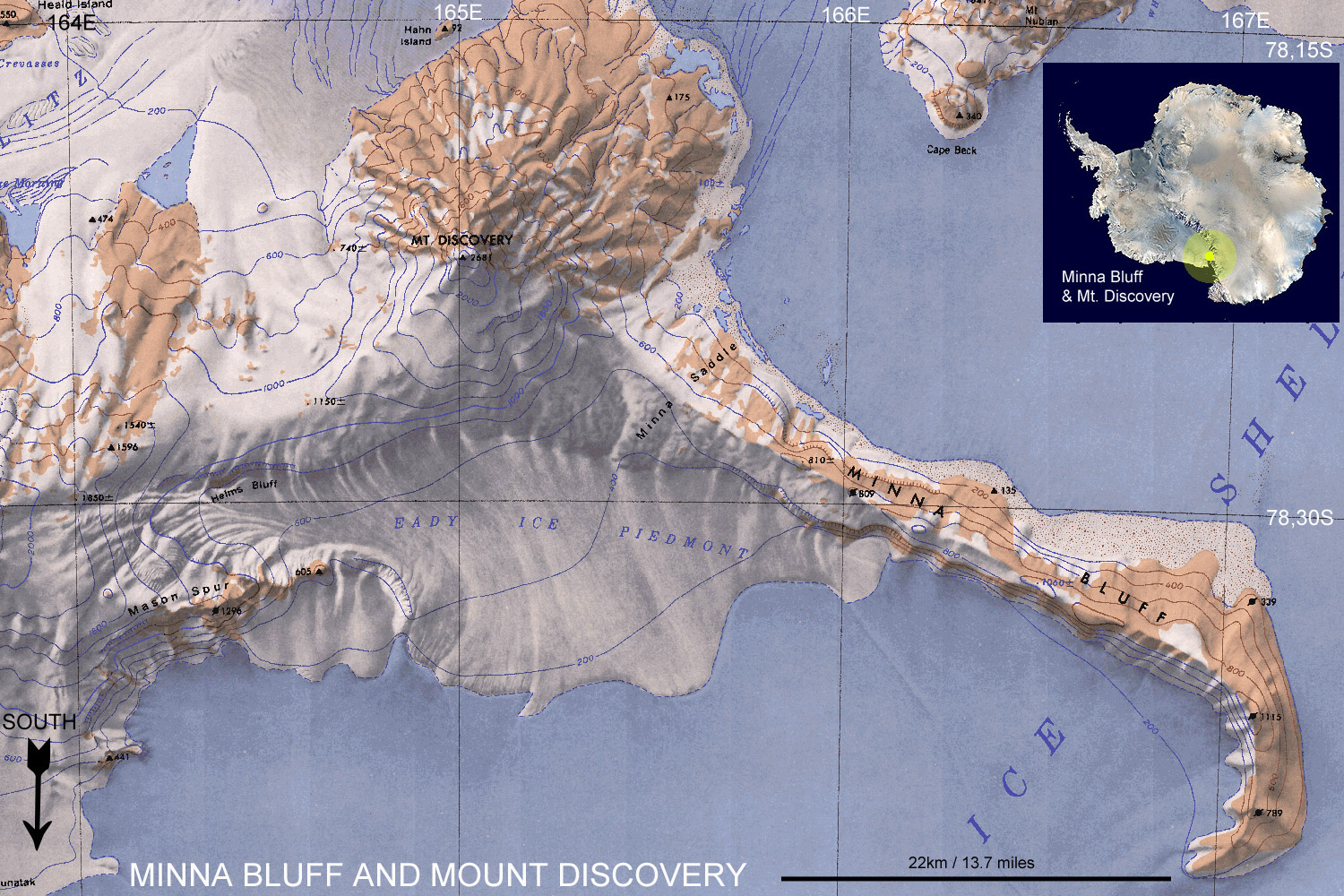
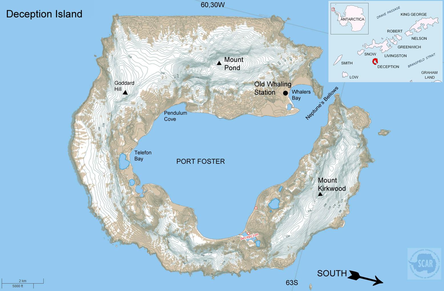
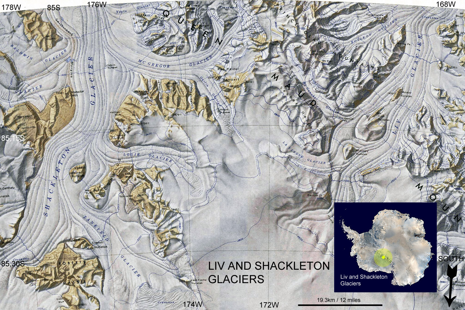
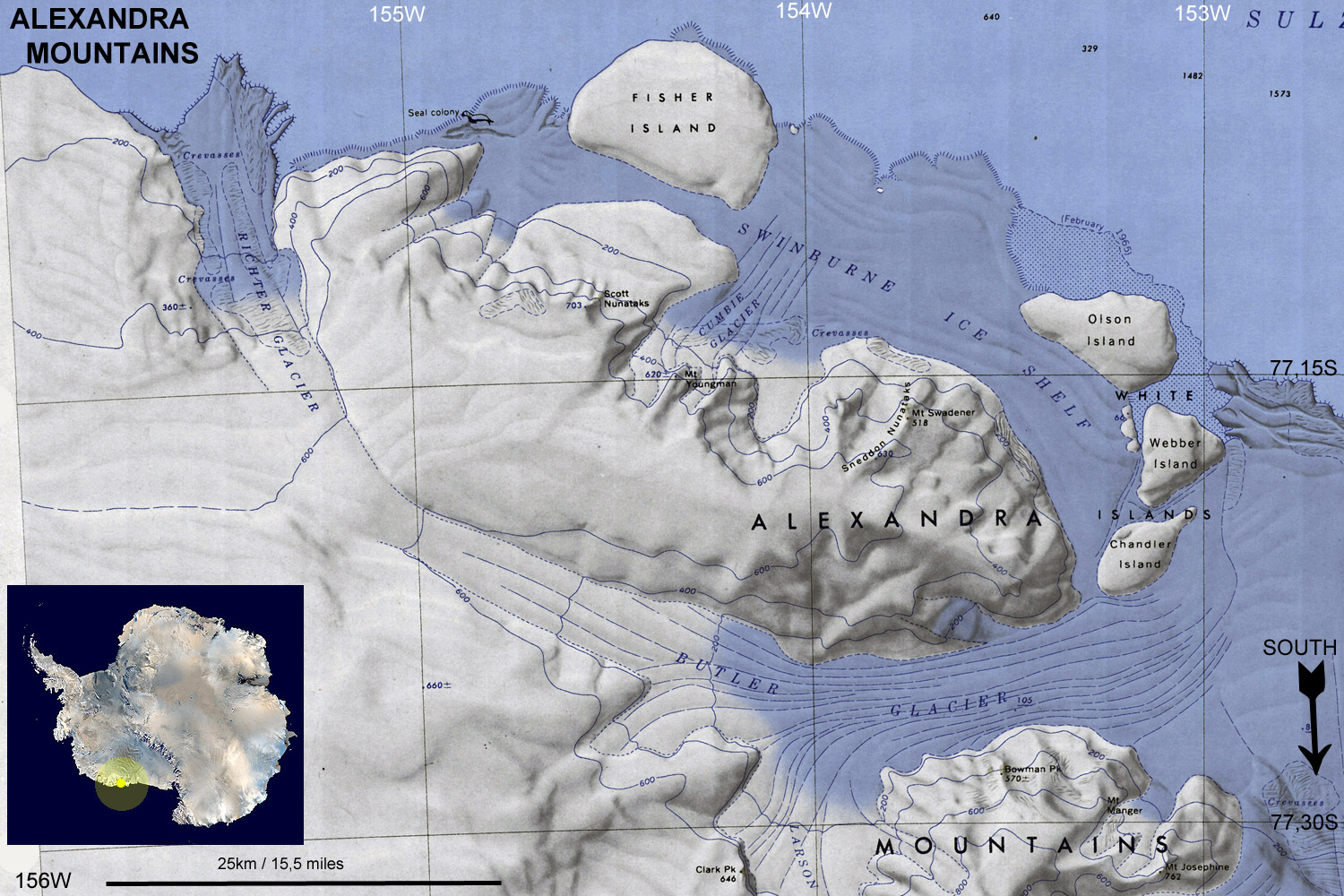
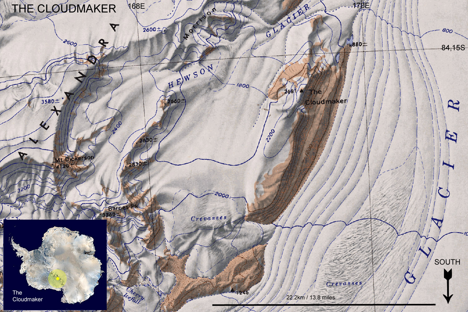
Topographic Reconnaissance maps of Antarctica. Originally published at 1:250,000-scale by the U.S. Geological Survey in cooperation with the National Science Foundation.
Antarctic
Digital Database Map Viewer - License terms and conditions
- Data is licensed according to Creative Commons CC-BY - data
is free to use, modify and redistribute provided the source
"SCAR Antarctic Digital Database" is acknowledged, and that
the disclaimer below is accepted.
Disclaimer - Information
in the Antarctic Digital Database has been obtained from sources
believed to be reliable but its accuracy and completeness, and
the validity of the opinions based thereon, are not guaranteed.
As every effort has been made to provide accurate information
in this database, SCAR would appreciate it if users could indicate
in writing any errors that may be noticed. SCAR is not inviting
reliance on these data, and the user should always check original
published data. The information in this database is subject
to change. Questions about the data should be addressed to Adrian
Fox
https://add.data.bas.ac.uk/repository/entry/show?entryid=f477219b-9121-44d6-afa6-d8552762dc45