The South Pole
What is it like at the South Pole? one of the most extreme occupied places on earth. For thousands of years, the South Pole was only imagined in theory, no-one even saw the continent of Antarctica that surrounds it until 1820. Today there is a busy scientific community and even visits by tourists.
This page is about the point at 90 degrees latitude south, 90°S, the Geographic South Pole and not the whole of Antarctica which is sometimes known colloquially as "The South Pole".
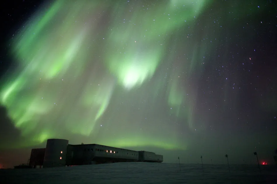 Aurora
australis in winter darkness over the South Pole station
Aurora
australis in winter darkness over the South Pole station
photo:NSF - Patrick Cullis
Where is the South Pole, What is There?
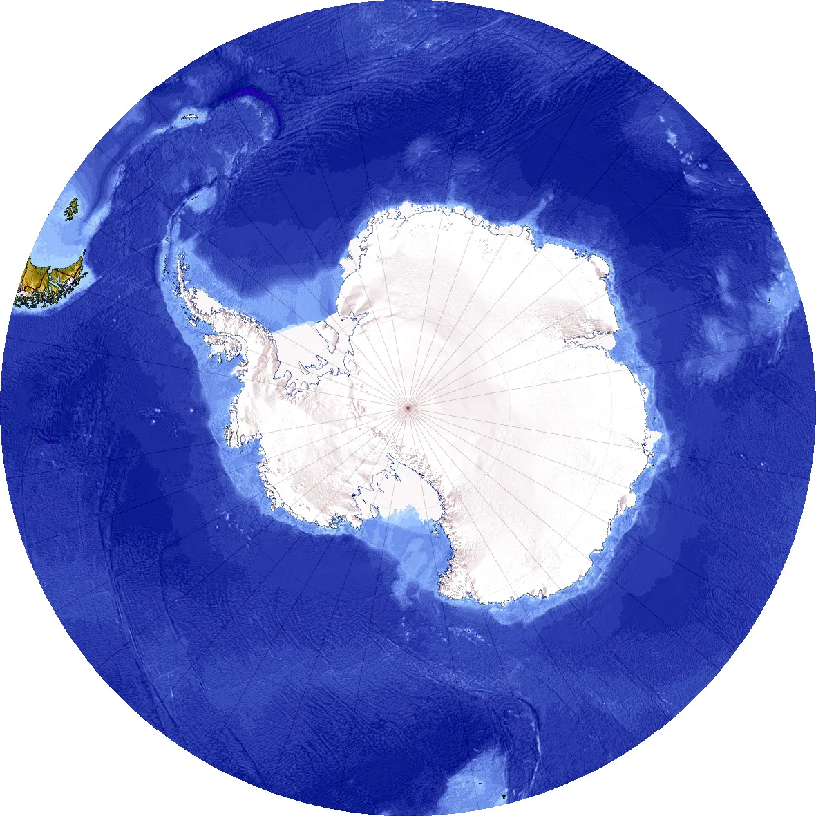
The pole is situated about 1,300km (800 miles) inland from the nearest open sea, it is at an altitude of 2,835m (9,300ft) above sea level due to the enormous thickness of the Antarctic ice sheet. The bedrock at the pole is thought to actually be about 57m (187ft) below sea level, in part due to the weight of all that ice pushing it down.
At the surface at the South Pole, there is just snow and ice, there are no other natural significant features, no mountains sticking through the ice (there are hills and mountains beneath the ice, but they aren't tall enough to reach through) no rock, no solid ground, just a vast endless plateau of more snow and more ice.
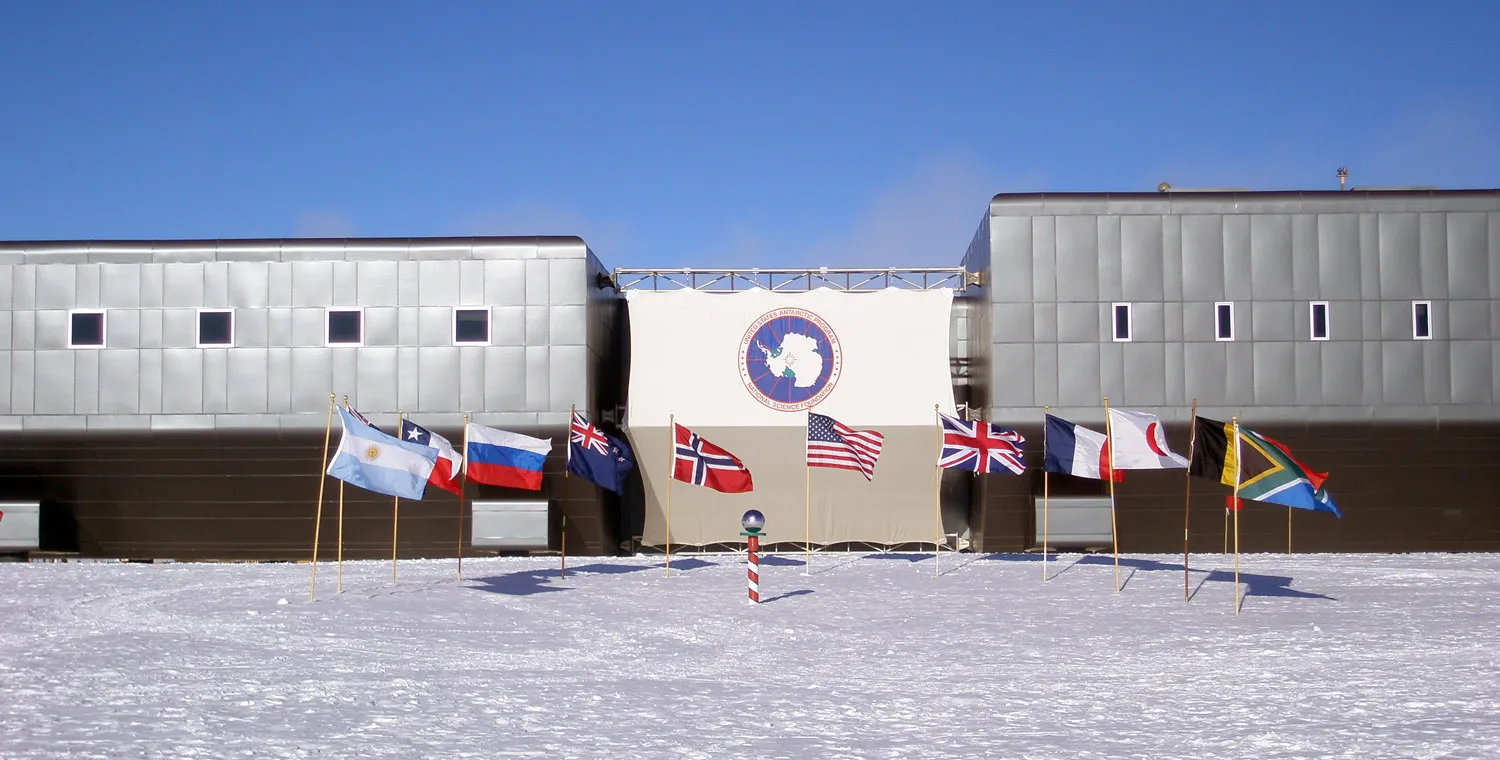
Oh yes, and a huge human settlement that is the Amundsen-Scott South Pole Station. This American run scientific station was established in 1956 and has been permanently manned ever since then. The current station is the third to be built, work started on it in 2003. In addition to the main station building there is a large collection of other structures in the area. Some are specifically designed and constructed scientific buildings, others are sturdy insulated tents that are used for temporary summer-only accommodation. There are cabooses or converted shipping containers that are fitted out for a particular purpose or scientific experiment.
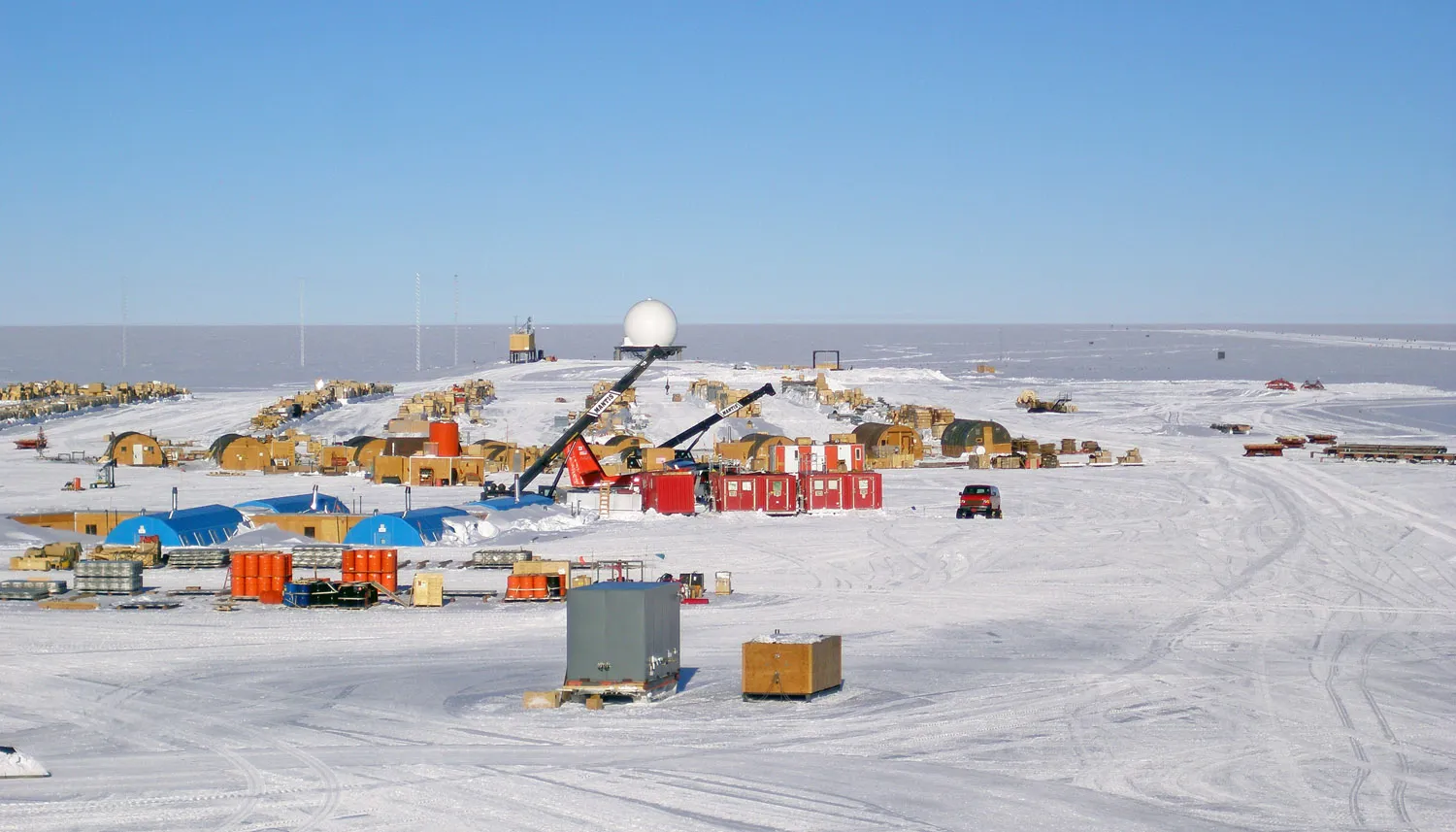
View from balcony at one end of the South Pole Station to the less pretty stuff at the South Pole - hypertats (blue) temporary summer accommodation, Twin Otter (aircraft) parking (behind red containers), Construction Camp, the Berms (lines of cargo), and Communications buildings (sphere is RF building).
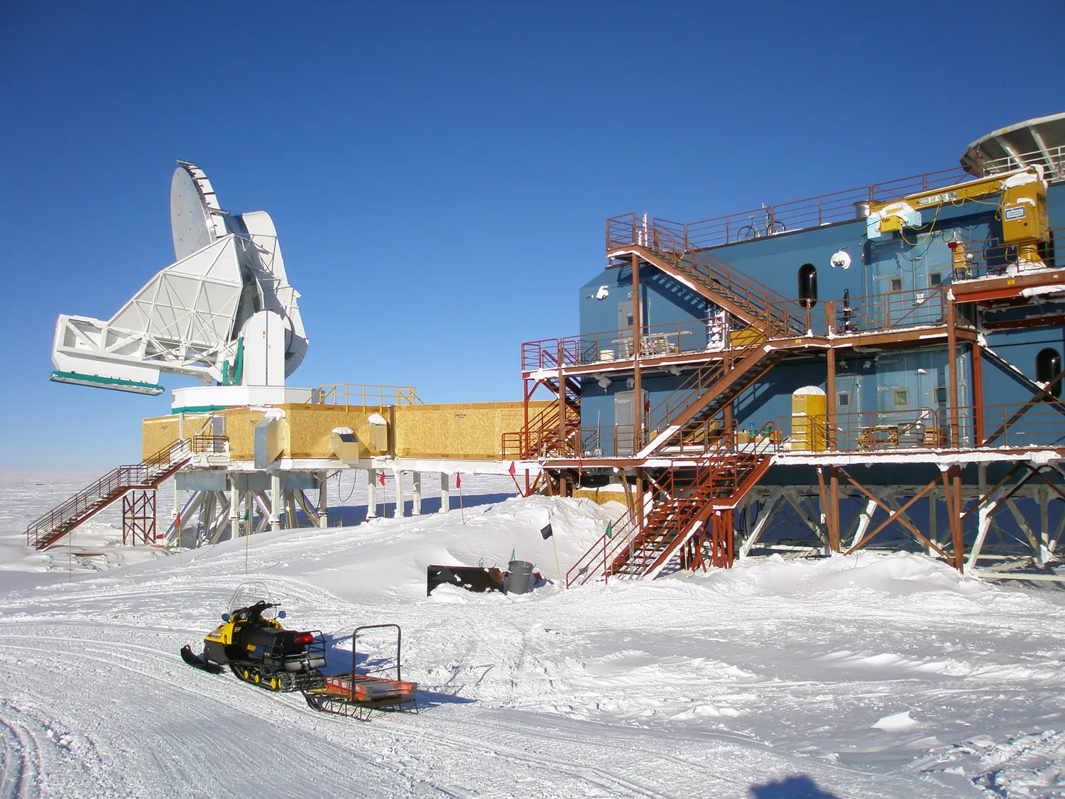
The 10 meter telescope and Dark Sector Laboratory (DSL) to investigate dark matter and dark energy.
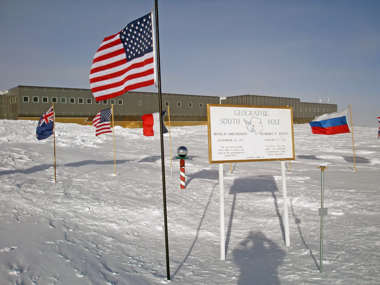
The actual South Pole. The red-and-white striped pole with the mirrored ball is the Ceremonial Pole. The Geographic Pole is the bronze marker on a silver rod. The Geographic Pole is moved about 10 meters every year, as the ice cap moves and carries the marker with it. The Ceremonial Pole is only moved when necessary. The Amundsen-Scott Station is behind the poles.
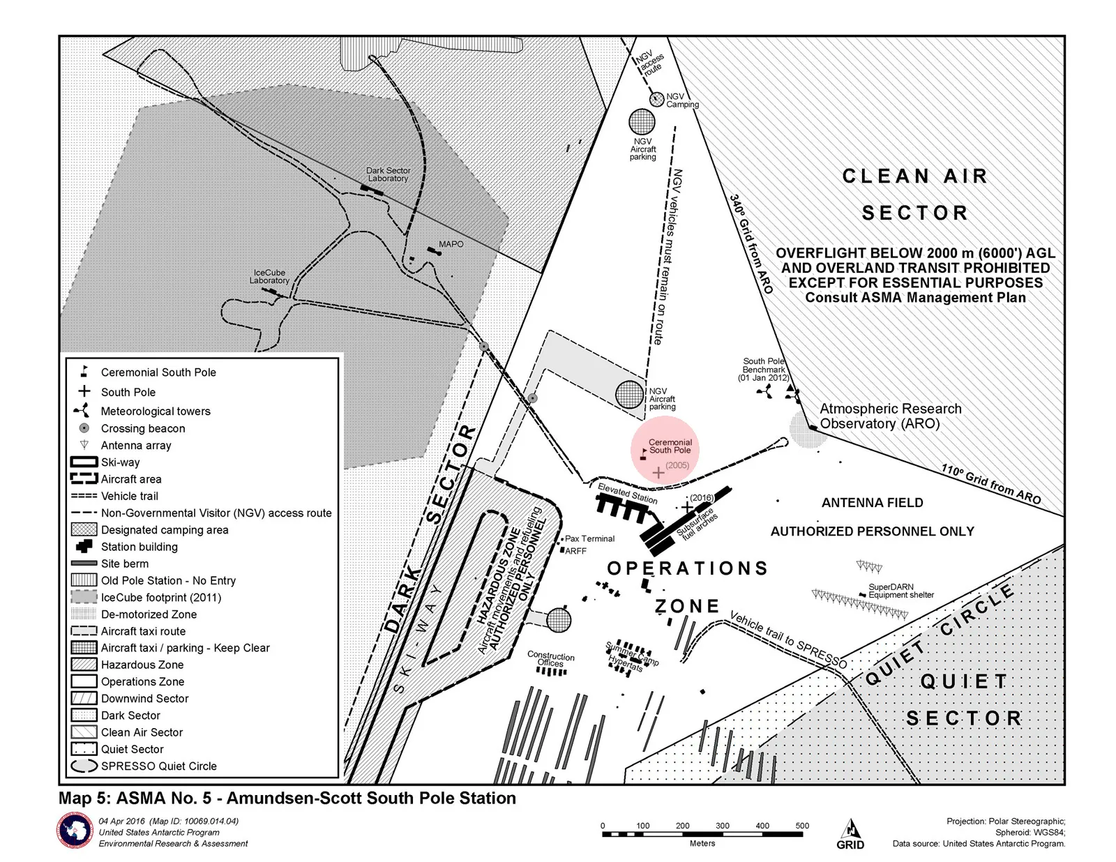
The South Pole Station Map. "Dark Sector" is protected from light pollution and electromagnetic radiation from the base for the use of telescopes, "Clean Air" is free (mostly) of exhaust fumes, "Quiet Sector" is away from any vehicles and noise where very sensitive seisomological instruments are located.
South Pole Strangeness
As you may imagine, such an unusual place as the South Pole has some peculiarities, here are some of them.
Sun Rise and Set
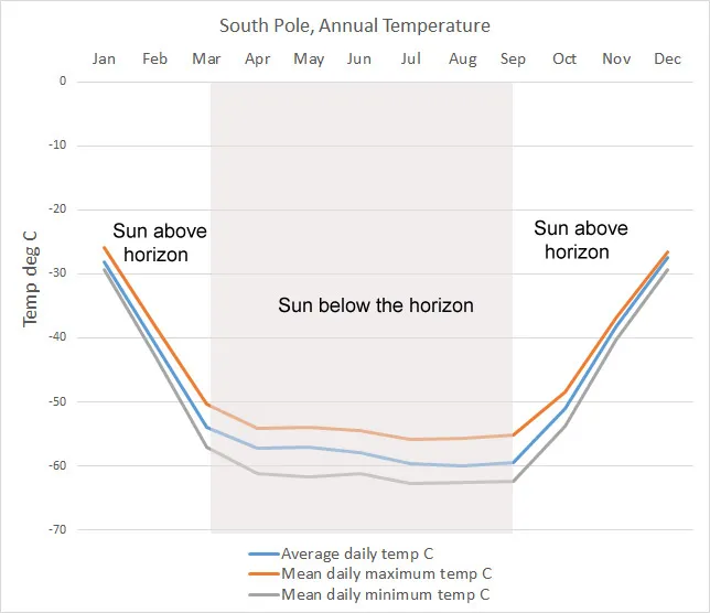
The sun rises once a year at the South Pole, it then stays above the horizon for 6 months before setting and remaining set for the next 6 months. It rises at the September equinox on the 21st and sets just after the March equinox on the 23rd. The temperature reflects whether the sun is above the horizon and how far above it gets.
Spin Speed
At the equator, you are moving at a speed
of 1,037 mph due to the rotation of the earth.
-
Sydney, 33.9 degrees South - 864 mph.
New York, 40.7 degrees North - 790 mph.
London, 51.5 degrees North - 649 mph.
Northern tip of Greenland, 83.6 degrees North - 116 mph.
South Pole 90 degrees South - 0mph
If you lay down so your navel was directly over the point of the South Pole, in a day, you would do a complete 360 revolution (with head and feet occupying time zones 12 hours apart).
Time
All time zones converge at the poles, so in a sense it is whatever time you want it to be. You might think you could take your cue from the sunrise and set and so use that, except that doesn't work as the sun unhelpfully only rises and sets once a year, see above.
The time at the South Pole is taken as being the most convenient for the people on the station there, which is New Zealand time as that is the main supply base, so the time at the South Pole is UTC +12.
The Christmas Round the World Race
There has arisen a tradition at the American Amundsen/Scott base at the South Pole for a "Race Around the World" that takes place on Christmas Day. All manner of transport is used to travel around the geographic South Pole so meaning that in passing through all time zones and lines of Longitude, the participants have raced around the world. The course actually goes around three times and covers two miles. video here .. and here.It wasn't always like this...
Despite being a featureless flat bit of ice and snow surrounded by identical looking featureless ice and snow for hundreds of miles (at least) in all directions, the South Pole was a very sought after geographical prize. After several teams had attempted to reach it including an abortive attempt a few months before being successful, Norwegian Roald Amundsen arrived there first as part of a team of 5 men with 18 dogs pulling sledges on the 14th of December 1911. Just over a month later Englishman Robert Scott also reached the pole with a team of 5 men having manhauled there. While Amundsen's team all returned home safely, Scott and his men died on the way back from the pole.
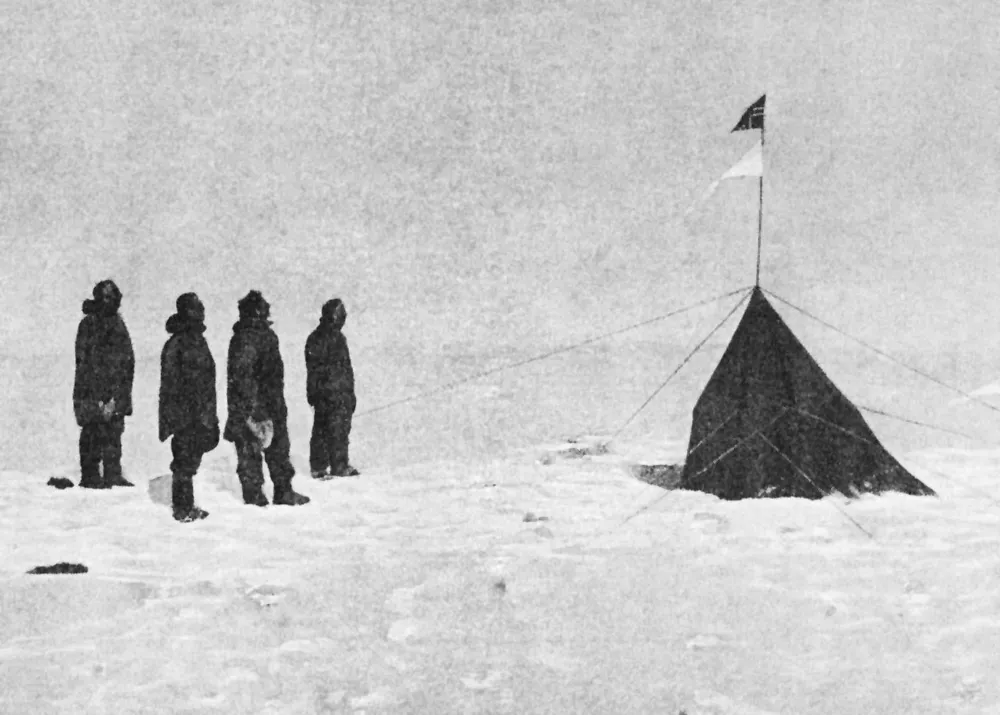
Amundsen and his party at the South Pole
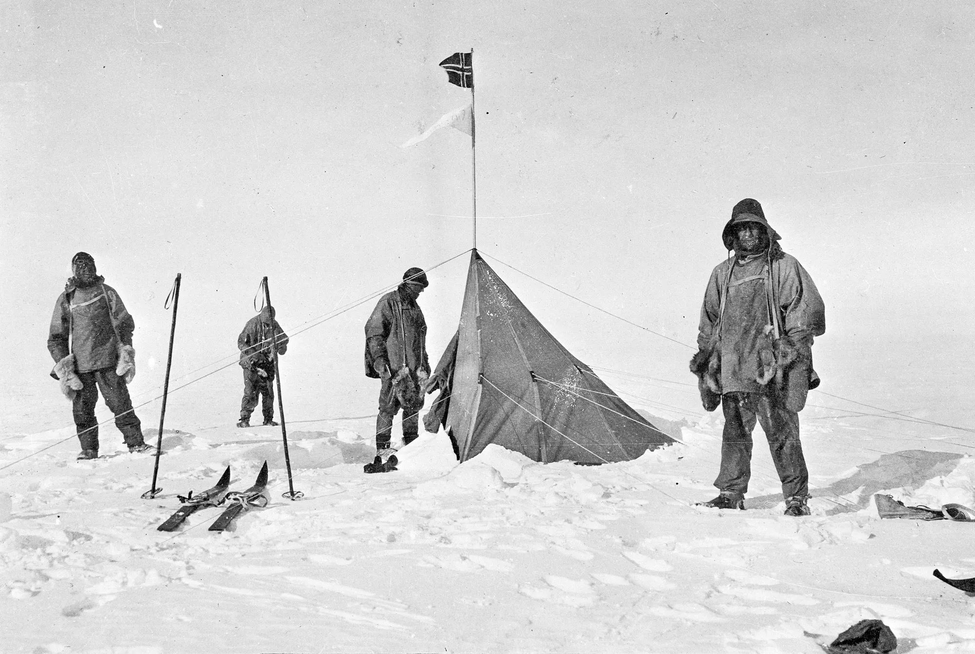
Scott and his party at the South Pole by the Norwegians tent
South Pole Visits Timeline
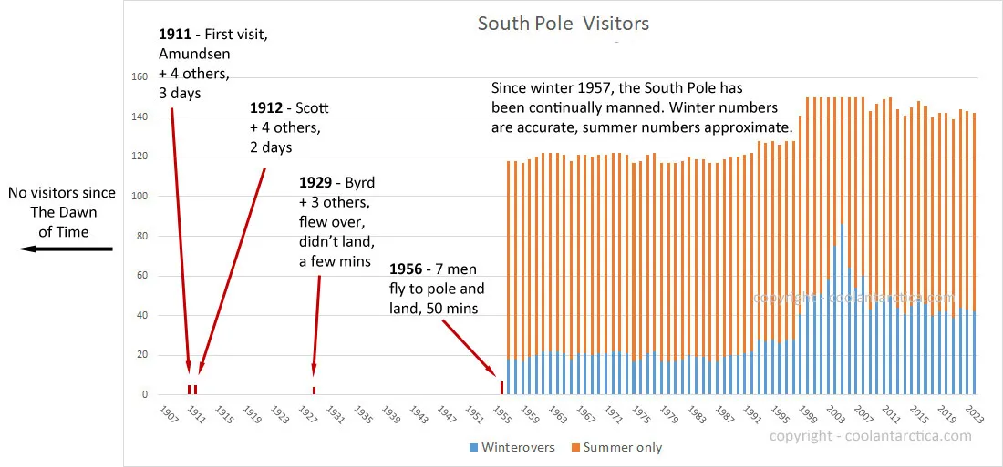
14th December 1911, Friday, about 3 p.m. - Roald Amundsen arrives with 4 other men and 18 sled dogs.
18th January, 1912 - Robert Scott arrives with 4 other men to find they have been beaten to the pole by about a month.
November 29th, 1929 - Admiral Richard E. Byrd, and 3 others fly over the South Pole. They fly around a bit to make sure they reached it.
October 31st 1956 - Admiral George J. Dufek of the US Navy lands in a transport plane named "Que Sera Sera". The US Amundsen-Scott South Pole Station is established by air over 1956-1957 for the International Geophysical Year, the station has been continually occupied until the present day.
January 4, 1958 - Edmund Hillary, January 19, 1958 - Vivian Fuchs, with their own parties are the first to reach the Pole overland since Amundsen and Scott during the Commonwealth Trans-Antarctic Expedition.
1987 - First tourists flown to the pole.
December 30th, 1989 - Arved Fuchs and Reinhold Messner are the first to cross Antarctica via the South Pole without animal or motorized assistance, they use only skis pulled by kites.
South Pole Markers
A metal marker is placed at the geographic South Pole on January the 1st each year and the pole is moved usually by about 10m as that is how far the ice cap has moved carrying the pole with it from the true South Pole point in the previous year. A tradition has arisen for an over-winterer at the South Pole station to make a new marker to take the place of the old one when it is moved again. The old markers are displayed in the adjacent Amundsen-Scott South Pole research station.
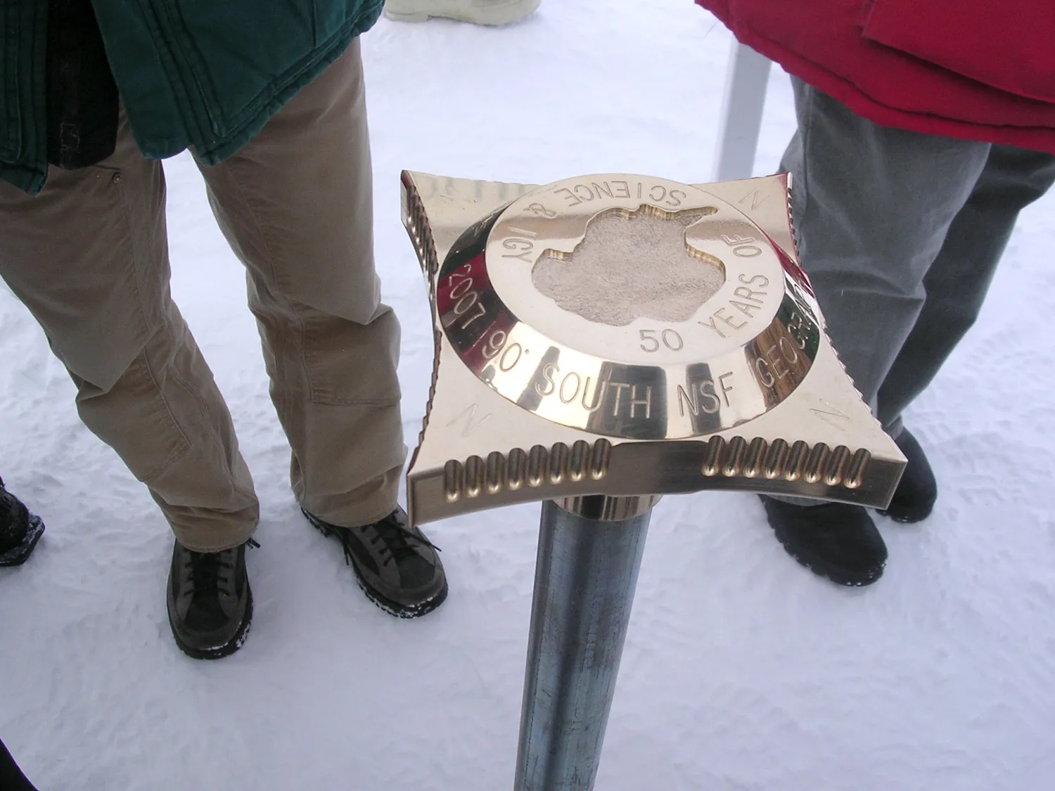
The 2007 marker
photo:
NSF, Andy Martinez
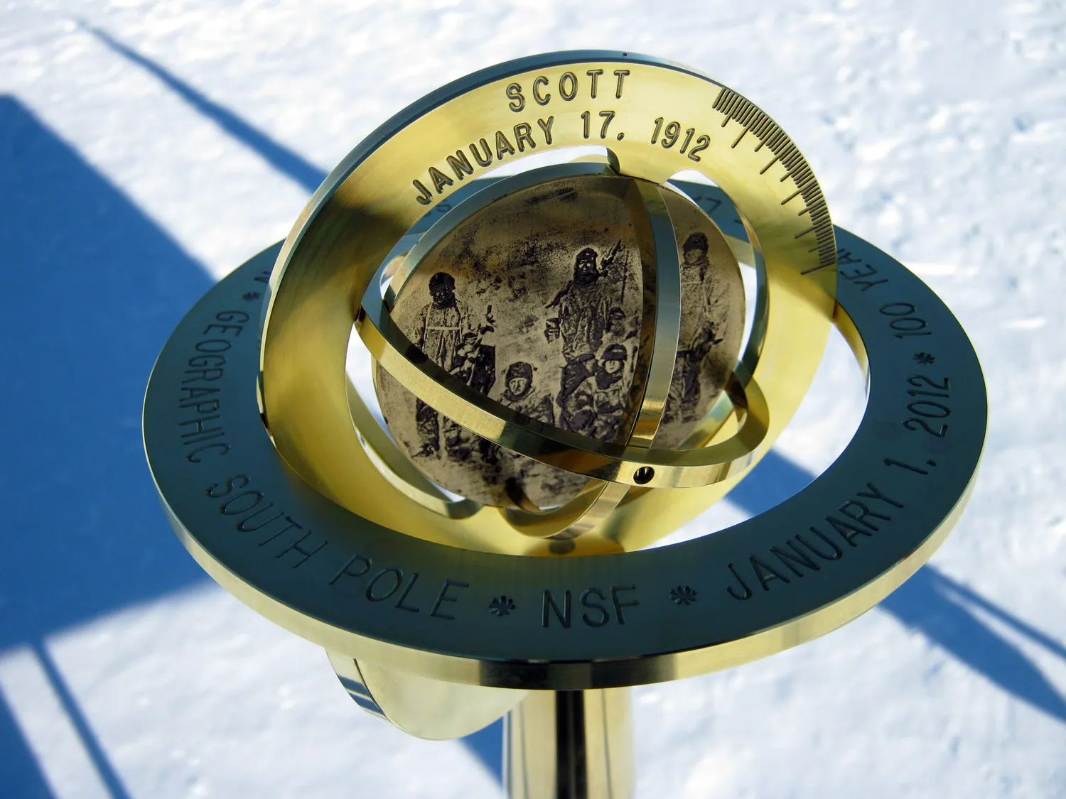
The 2012 marker
photo:
NSF, Katie Hess
Does it Snow at the South Pole?
Snow accumulates at the South Pole, but it is not always from snowfall, atmospheric conditions can cause ice crystals to fall from what appears to be a clear sky. About 60-80mm / 3" per of snow/ice builds up at the pole every year, none of this melts so buildings become buried over time, wind blown snow forms drifts and tails around buildings, so the build-up in some places can be significantly greater.
The short explanation is that the snow surface and air immediately above it is colder than the next layer of air that goes up 100's or 1,000 feet, then it gets colder again. This warmer layer holds more moisture which falls out as ice crystals in contact with the colder near-surface air.
Longer explanation below.
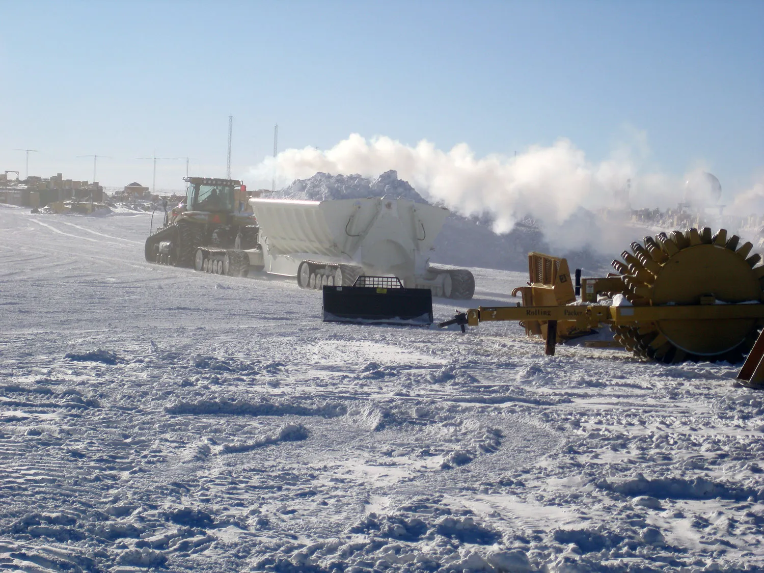
Vehicles - Re-Arranging the Snow at the South Pole. Snow builds up in the wrong place and gets in the way, there's something appealing about the notion of people being sent to the South Pole to re-arrange the snow.
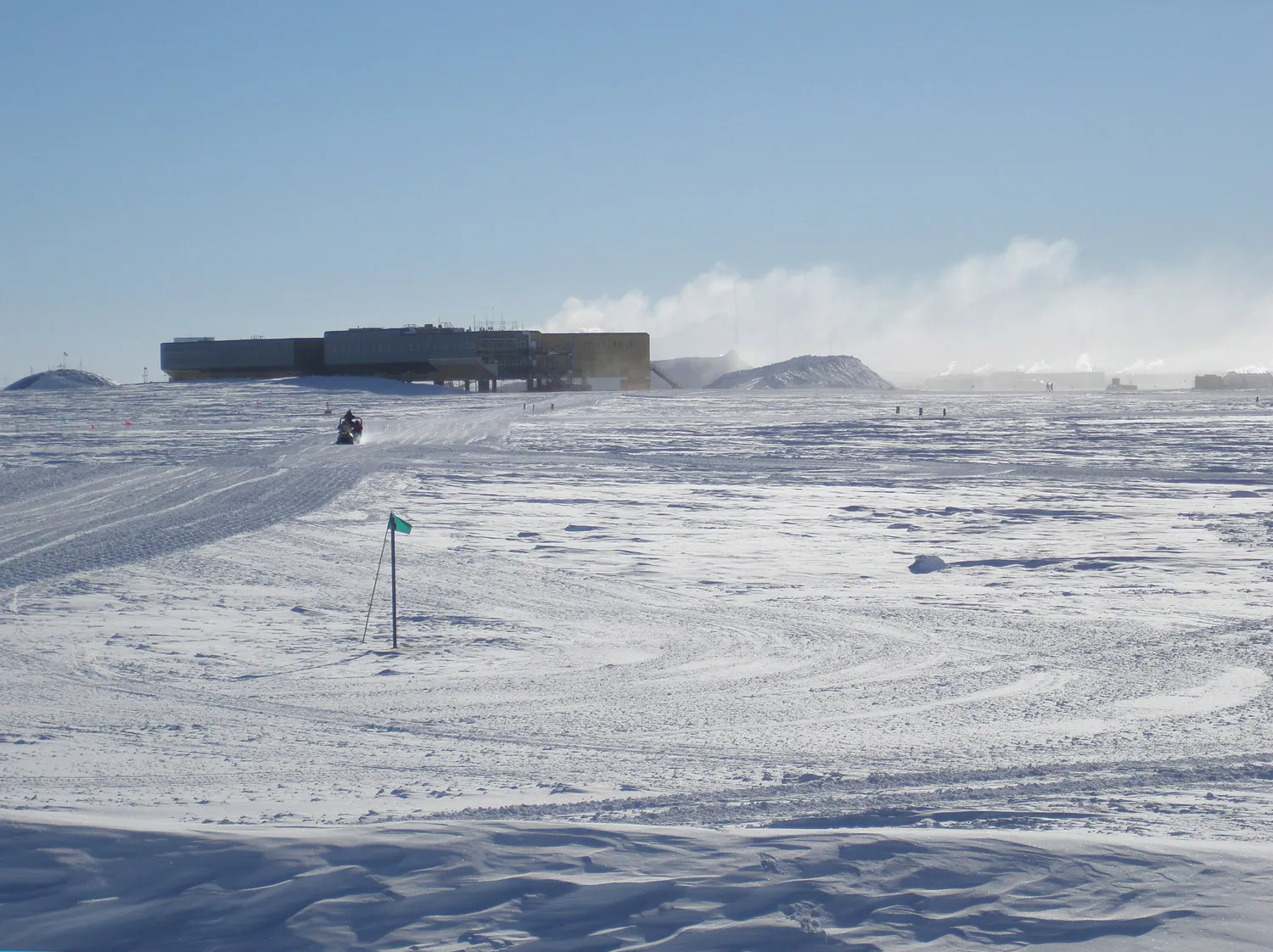
Snow build up around the station. There is also a large pile of snow to the right of the station that has been dumped there after being dug out from where it wasn't wanted. There's surplus snow at the South Pole - who knew?!
This explanation comes from Rusty Kapela who was lucky enough to spend 3 months at the South Pole as a graduate student assistant meteorologist.
As you know, the interior part of Antarctica is much
colder than the coastal areas which are moderated by the "heat"
released by the oceans. On most days in the interior
the ground cools dramatically due to radiational cooling
(heat escapes upward from the ground/snow surface).
Therefore, the air temperature just above the ground undergoes
extreme cooling since the snow surface is cooling most of
the time, especially in winter.
However, a
layer of air only a few hundred to perhaps a thousand feet
or so above the snow/ice surface doesn't cool as much
or as fast as the snow surface itself. The result is a reversal
of the air temperature as one goes up from the snow surface.
This reversal is known as an inversion. Air temperatures
in the inversion may be 10 to 25 degrees C warmer than surface
temperatures. Above the inversion temperatures become
colder again.
Keep in mind that "warmer" air can potentially
hold more moisture than colder air. Therefore, greater amounts
of moisture are found within the inversion. The relative
greater amounts of moisture in the inversion ultimately
precipitates out as ice crystals. However, there isn't
enough moisture in the inversion to form clouds that humans
can see.
On some days the ice crystal fallout becomes
more intense and can actually reduce the horizontal surface
visibility down to below 1 mile and in extreme cases down
to 1/4 mile. When this happens it make look like there
is a haze near the ground reducing visibilities - but in
fact it's ice crystals. Surface visibilities
below 1 mile can affect the takeoffs and landings of airplanes.
When I was at the South Pole, I noticed that the
more intense ice crystal fallouts occurred when the surface
winds were blowing from lower to higher elevations from
the Weddell Sea area up to the South Pole. In these cases
the inversion and it's moisture were undergoing additional "squeezing
and cooling" due to the upslope flow. Air cools as
it goes uphill and it can't hold as much moisture as
it originally did. This squeezing/cooling forces moisture
within the inversion to precipitate out more intensely as
ice crystals. The opposite was true if surface winds were
blowing downhill/downslope from the higher Eastern Antarctica
plateau area - better visibilities and less intense ice
crystal fallouts or no ice crystals.