Maps of Antarctica
It can be difficult to envisage a whole continent and its place in the world. Here are some composite maps and pictures that give a good impression of Antarctica in three dimensions with and without ice and in relation to how it fits into the globe.
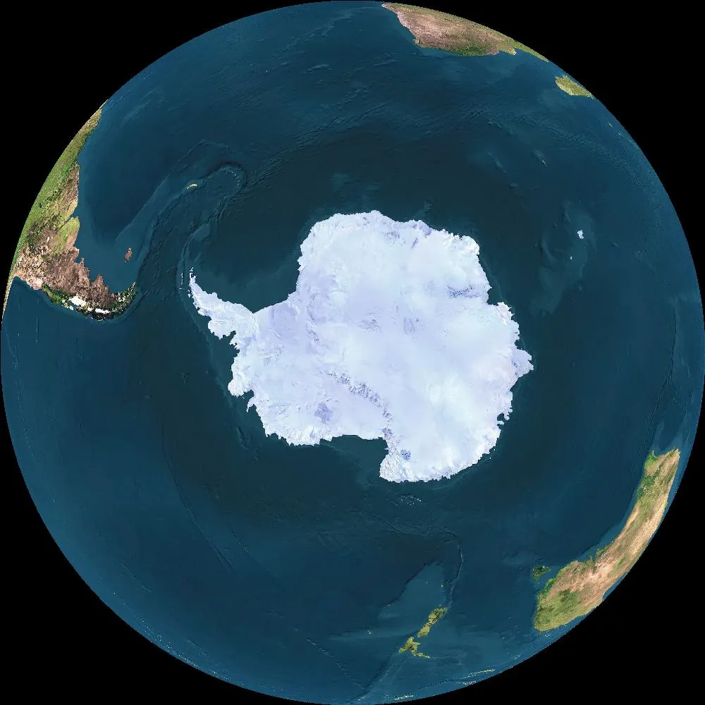
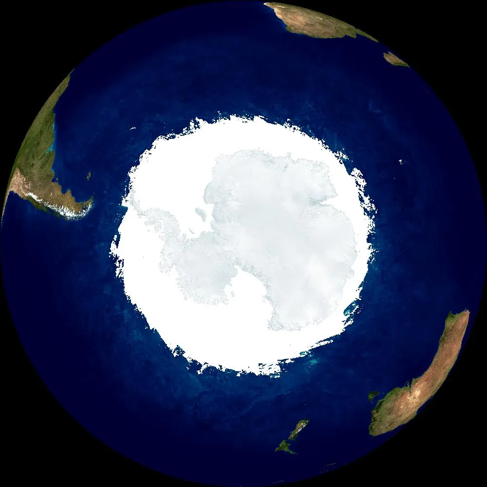
Composite image of Antarctica and southern hemisphere South America (left), Africa (top right) and Australia / New Zealand (lower right). The earth could never be viewed in this way as in reality one half of this view would be in daylight and the other in darkness
The outline of Antarctica is frequently different in different images as some represent the continent during the summer, some during the winter and some in between. At its greatest extent the winter sea-ice just about doubles the size of Antarctica.
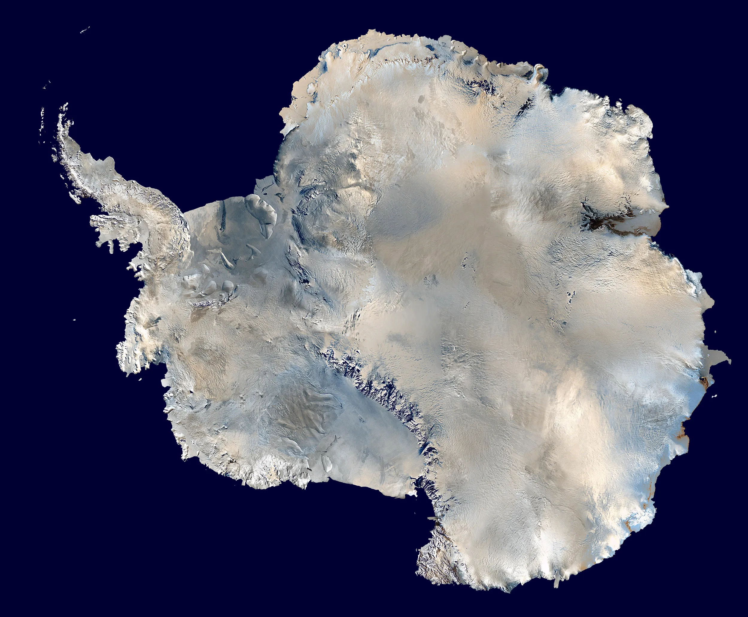
Even in the summer the shape of the coast-line varies as very little of it consists of rock leading down to the sea. Much of the edge of Antarctica is an ice-edge of constantly flowing and ebbing glaciers, ice shelves and sea-ice that sometimes may break out each year, sometimes not for a few years. A bit of a map-makers night-mare in fact. No sooner is a map made, than it's out of date.
For other views of Antarctica (and the rest of the world too) take a look at the excellent Earth viewer, this allows you to choose your position above the earth according to longitude and latitude and even the day and time of year to follow where the sun goes with the seasons.Free use downloadable
maps of Antarctica, all approx. 2400px wide.
Unlabelled free use relief map of Antarctica
Basic labelled free use map of Antarctica
Simple free use outline map of Antarctica
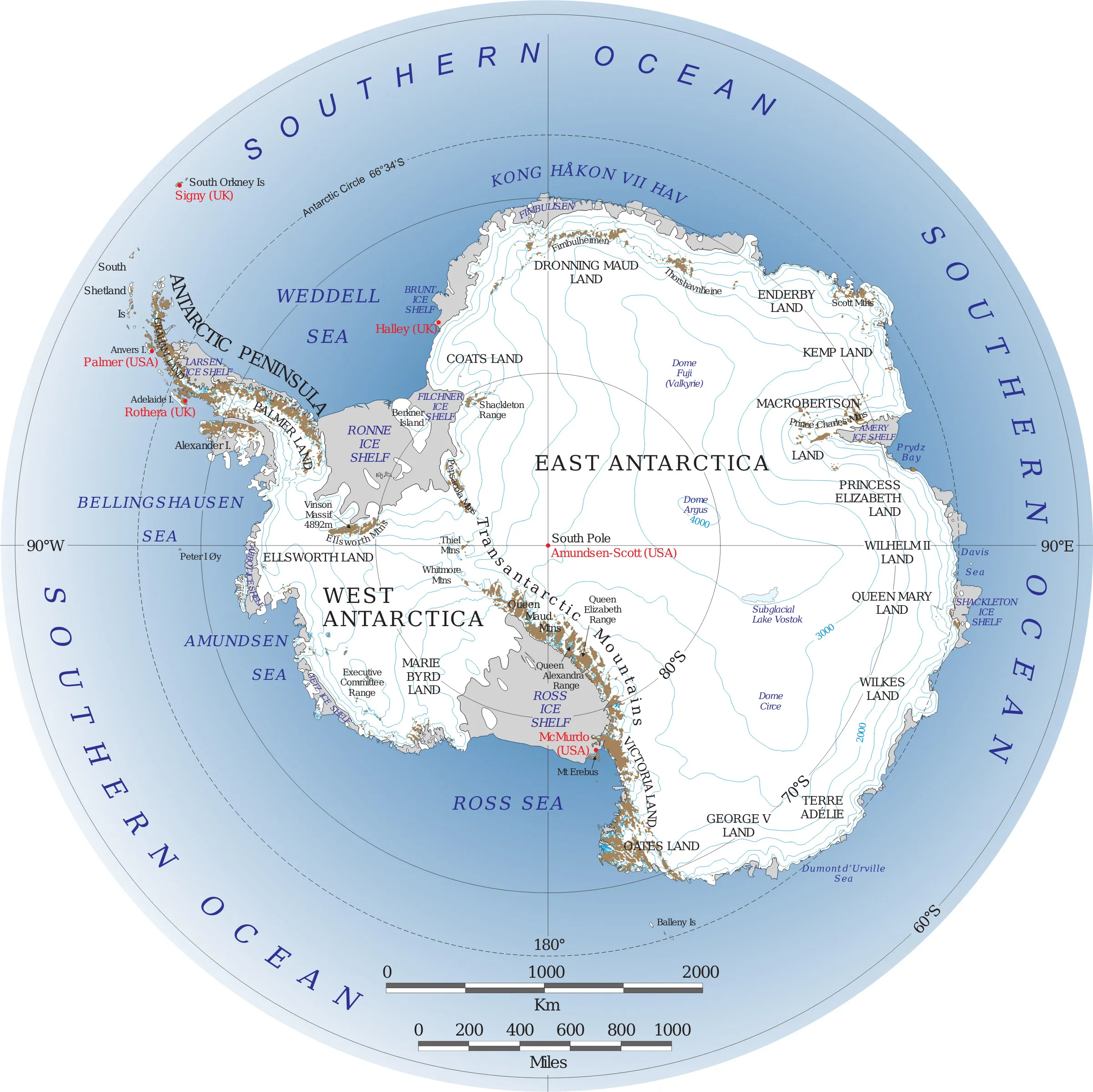
Political Maps of Antarctica
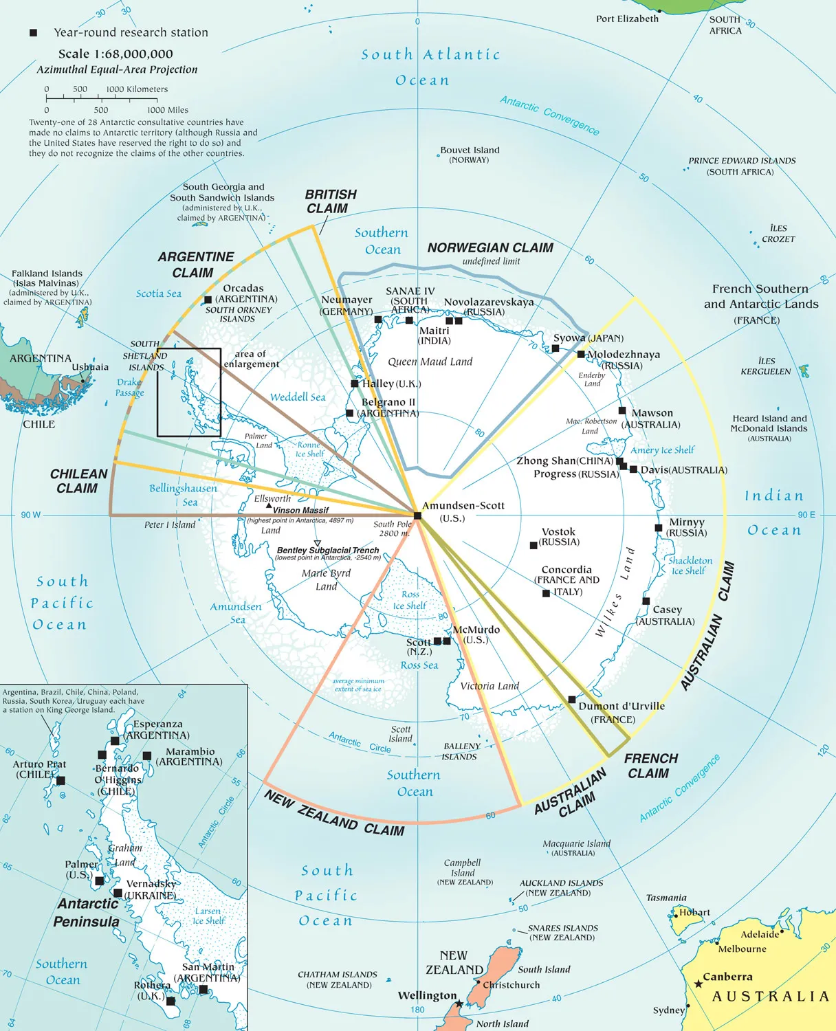
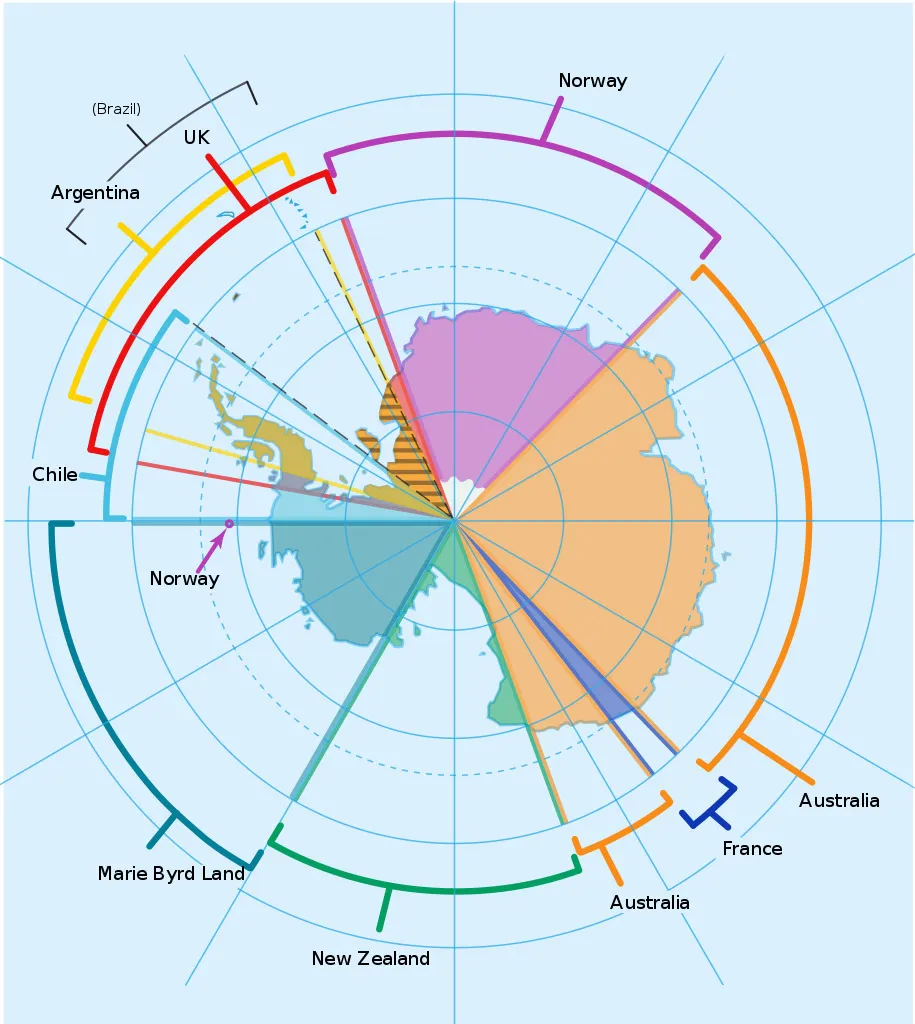
Picture by Lokal_Profil used under Creative Commons 2.5 Attribution Share Alike Generic licence
No parts of Antarctica are "owned" by any single country, these are historical territorial claims that pre-date the Antarctic Treaty of 1961, these claims are put on hold while the Treaty is in force and no new claims will be recognised.
Bedrock - Under the Ice
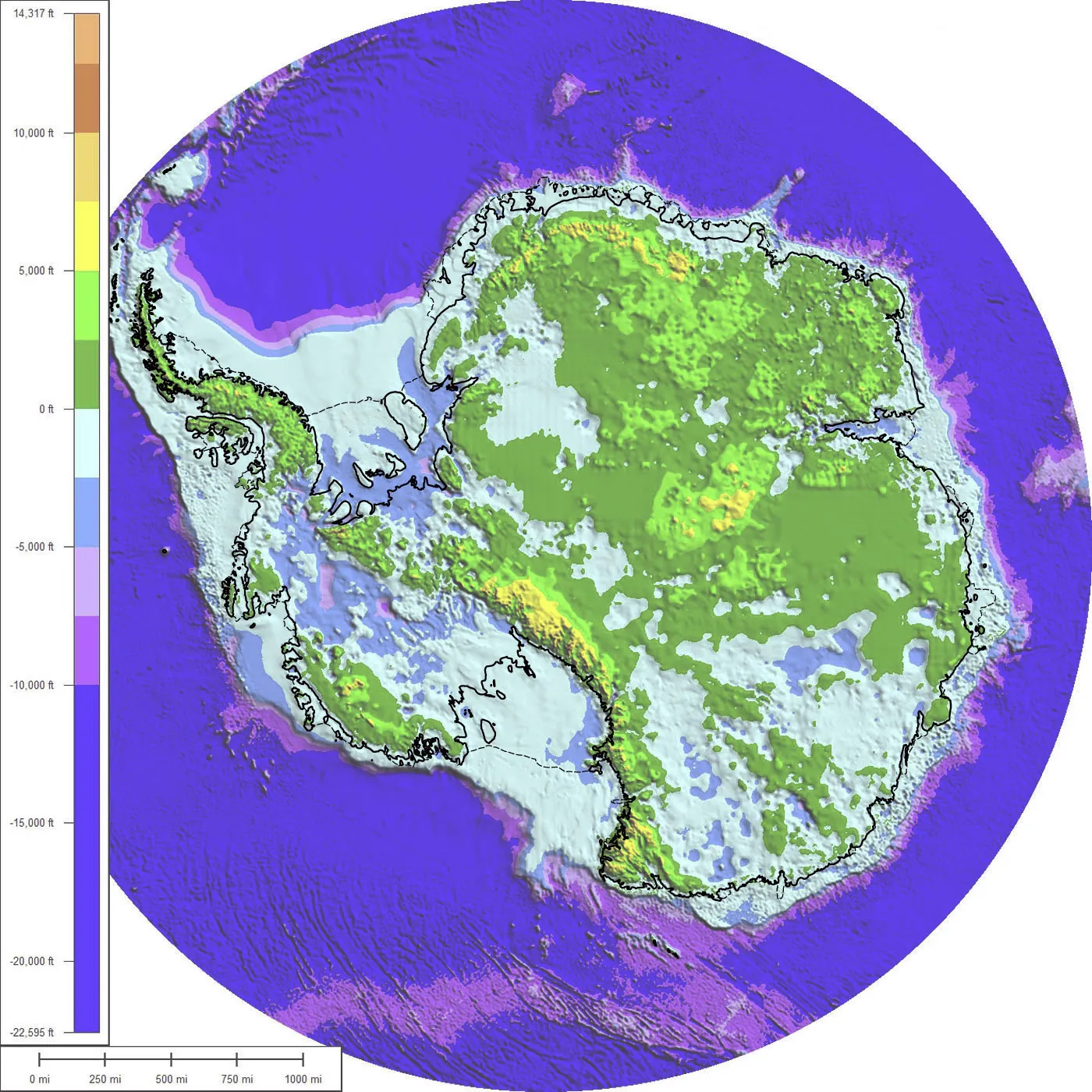
The bedrock of Antarctica under the ice, green
to brown areas are above sea level, blue to purple
are below
Picture:
Paul V. Heinrich, used under Creative Commons Attribution
Share Alike licence 3.0 Unported
Antarctica as it would be seen if the ice were
removed, this is the amount of the bedrock that
is above sea level, if the ice were removed, the
rock would slowly spring back again as the weight
of the ice is pushing the rock further into the
planets surface.
Picture:
Memtgs, used under Creative Commons Attribution
licence 3.0 Unported
Much of the continental "land" area of Antarctica
is actually currently depressed below sea level due to the
weight of the ice above it. The above images do not take
into consideration that sea-level would rise due to the
melted ice or that the land would slowly rise again over
the period of a few tens of thousands of years.
It
is estimated that the land is pushed down about 1,625ft
(500m) by the ice. The average depth of the ice sheet is
more than 2,000ft (6,600ft).
Antarctica under the icesheets, video 1 min 59 secs - NASA
3D Views
Antarctica in 3D showing ice cover
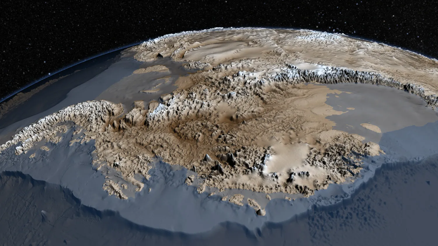
Antarctica in 3D showing bedrock beneath the ice
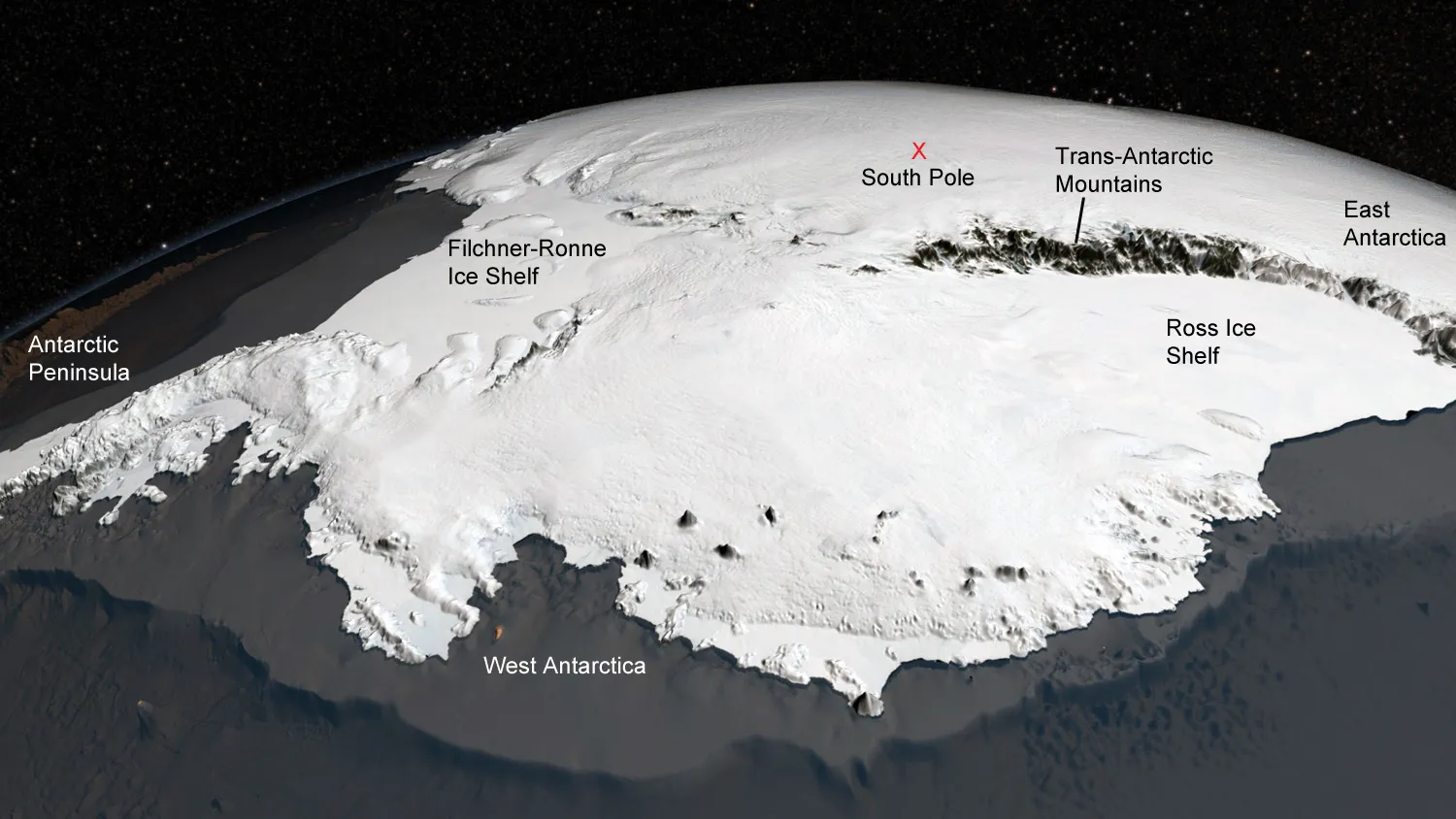
3-D computer generated images taken from hundreds of data points. I particularly like these as they give a feeling for the height of Antarctica. The average height of the continent is 2,400m (8,000ft) as against the next highest which is Asia at an average of 900m (3,000ft).
The high dome of East Antarctica is clearly seen as is the elevation of the South Pole and the formidable barrier presented by the Trans-Antarctic Mountains which usually just appear as a diffuse line running across maps as seen from above.
Sea Ice Cover
Winter sea-ice around Antarctica, 2nd August 2016
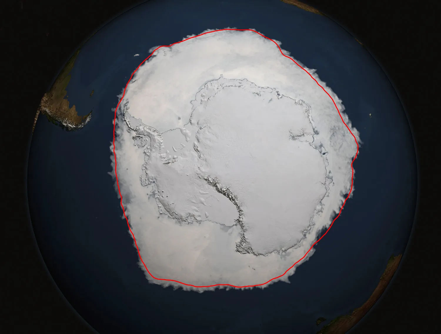
Another view of winter sea-ice around Antarctica, the red line shows the annual average
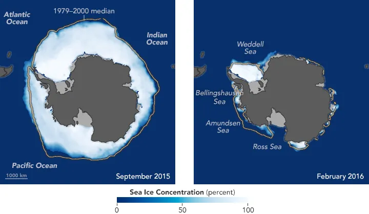
The overall area of Antarctica including sea-ice cover doubles in size between the minimum and maximum extents. This sea-ice (along with extreme cold, storms and darkness) is what shuts Antarctica off from the outside world during the winter months.
Unless otherwise noted, pictures used courtesy of NASA