John Franklin, Erebus and Terror
Map of the North-West
Passage
John Franklin North-West Passage - the story | Franklin North West Passage Timeline | Erebus and Terror in Antarctica
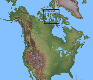 Right
- map of North America showing the enlarged area below where
Franklin's Expedition was "lost" and where much of the search
activity took place.
Right
- map of North America showing the enlarged area below where
Franklin's Expedition was "lost" and where much of the search
activity took place.
Key:
1 - Cornwallis Island, after entering Lancaster
Sound from Baffin Bay in July 1845, the Erebus and
Terror circumnavigated this island by initially sailing
along the...
2 - Wellington Channel. This
was where many of the rescue expeditions looked for Franklin
and his crews even as late as 1852, six years after they had
actually left the area.
3 - Beechey Island,
the Erebus and Terror spent the first winter
of 1845-6 here and where subsequent rescue missions themselves
wintered and left supplies in case any survivors of the Franklin
party should return.
4 - Peel Channel, the
Erebus and Terror sailed down here in the
summer of 1846 an unusually ice free summer.
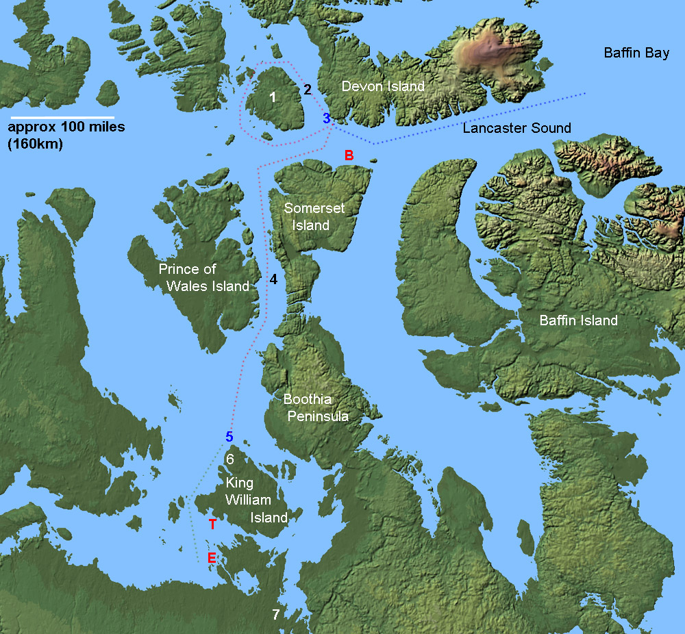
Maps used by courtesy of the USGS, modified for use here.
5 - The approximate wintering point for the second
winter 1846-7 north of Prince William Island.
6 - Victory Point on Prince William Island
where a large amount of equipment was found by McClintock in
1859.
7 - The mouth of the Back Fish River
(also known as Back River or the Great Fish River), where the
crews were thought to have tried to reach in order to walk out
of the Arctic following the loss of the ships.
E - The wreck of the
Erebus was found here in
September 2014
T
- The wreck of the Terror was found here in September
2016
B - The wreck
of the Breadlebane supply
ship lost in 1853, found in 1980, investigated in 1983 and again
in 2014.
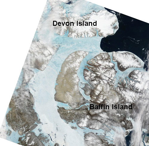
Picture right - A satellite picture of part of the above area taken on the 27th of June 2002. This is early in he season still for ice melt and break-up, it gives an indication of the degree to which the area amongst the islands is choked with ice making shipping movements difficult to say the least!
The ice in the various channels can be very variable from year to year which seems to have been a contributory factor to the lack of success of rescue missions. The Erebus and Terror sailed down the Peel Channel in summer 1846 which was clear that year but choked with ice so blocking ships for the next few years.
The Remains of Northumberland House on Beechey Island showing the Memorial (white) and cliff behind. This hut was built in 1854 and filled with supplies for any survivors who might reach it again. The Erebus and Terror wintered here in 1845-6 and left in summer 1846. It is an especially bleak and isolated place.
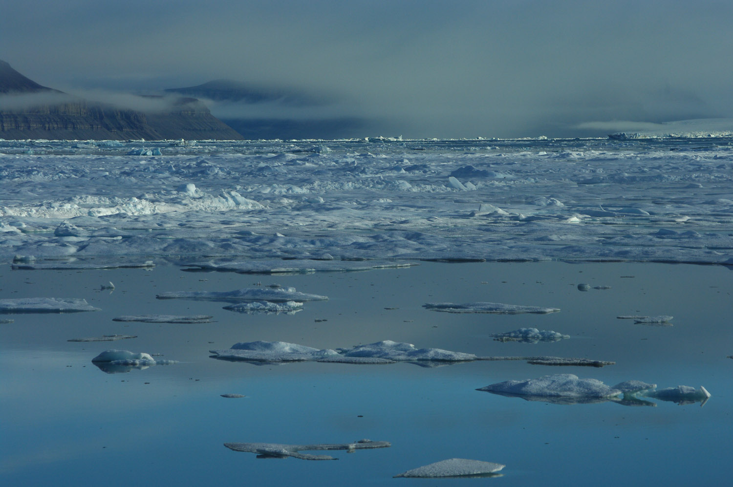
Lancaster Sound, looking towards Devon Island, a wide channel allowing relatively easy access to the deeper regions of the Canadian Arctic in most summers.

Summer pack ice in Lancaster Sound
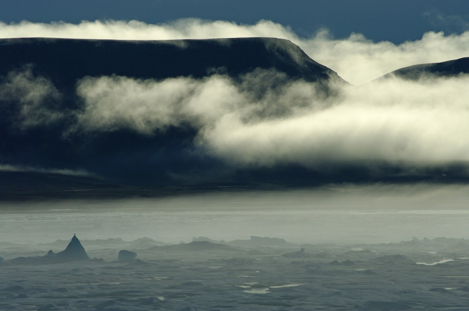
Lancaster Sound in calm August weather, 2010, benign conditions that Franklin and those on rescue expeditions will have encountered at some time before the sea froze the ships in for the winter - or two, or three...
John Franklin North-West Passage - pictures and story | Franklin North West Passage Timeline